Wednesday, December 27, 2006
its got a basket, a bell, lots of things to make it look good
Riding around Santiago on my sweet new ride is a delight. The city is almost perfect for biking (a tad too much traffic, but even they are pretty considerate) moslty flat, smooth roads, lots of other bikes around, and bright clear weather...So far settling in has been going pretty well, I managed to get an apartmentin 2 days, in a nice enough area close to the main drag of the providencia neighborhood living with a 50something chilean man and a french engineering student. Santiago has a lot to offer, and the city seems really happening, a pleasant mix of New York Paris and Richmond. Although its more expensive than any other South American city (that I´ve visited) its still pretty afordable coming from the US, with $2 sandwiches and $1 coffee. Chilean spanish is a bit tricky though, faster, less articulated, with a thick accent and lots of slang, a week or so more and I´ll be able to understand a bit better hopefully...
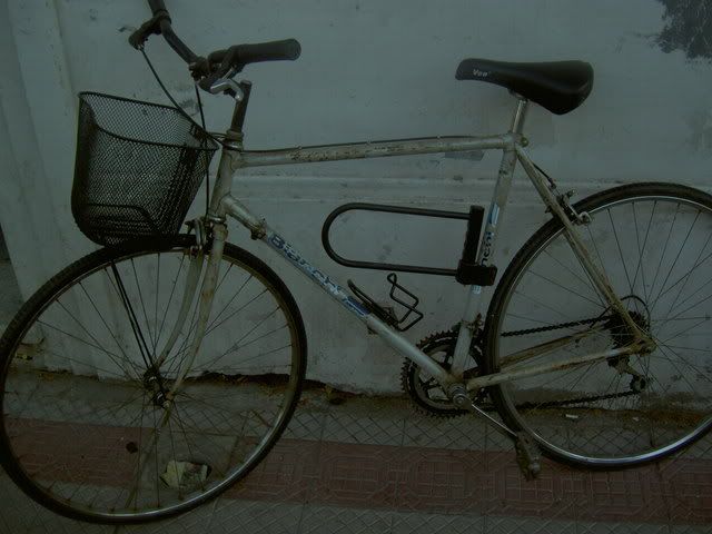
my bike

my room
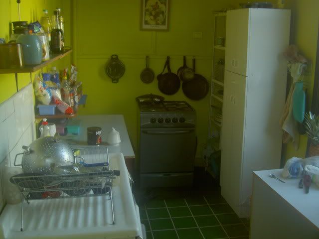
the kitchen
the kitchen
the adress:
nestor aracena 615
providencia, santiago
chile
look how bare theose walls are! send me some shit to cover them up!
my bike
my room
the kitchen
the kitchen
the adress:
nestor aracena 615
providencia, santiago
chile
look how bare theose walls are! send me some shit to cover them up!
Sunday, December 24, 2006
you might as well be walking on the moon
Tucked away in the southwest corner of Bolivia is some of the strangest scenery you'll see...a huge salt flat where a sea used to be before the Andes rose up and dried it out, volcanos, geyers, mineral filled volcanic lakes that end up in all sorts of colors , deserts with crazy shaped rocks, 'islands' covered with cactus...all sorts of crazy stuff. If Hunter S Thompson thought Las Vegas was a bit strange on a carload of drugs, good thing he didnt bring his show this far south.
My trip started in Uyuni, I arrived at about 2am on a bus from Potosi, slept for a bit and then got up and booked a place in a Land Cruiser leaving that day. Uyuni used to be an important train stop for trainsfull of Bolivian minerals heading to Chile for export, but since the decline of the mining industy, tourism has taken over as its main economic lifeblood. And running 4x4s through the salt flats and across the deserts is the main attraction: sustainable? hardly, but there's no real alternative to see this crazy part of the world, somehow riding a bike across it doesnt appeal. The first day we drove through the salt flats to Isla Pescado, stopping for lunch and to take some silly perspective photos. Because there is nothing in the background its easy to manipulate the perpective and make it look like someone is standing on someone else's hand, being stepped on, or in my case, being smoked (i'm waiting for this photo to arrive via email still) making big stuff look small, or alternatley, small stuff look big (see below). We spent the night at a tiny community called Bellavista on a hill overlooking the Salar; at sunrise the next morning the town definatley lived up to its name.
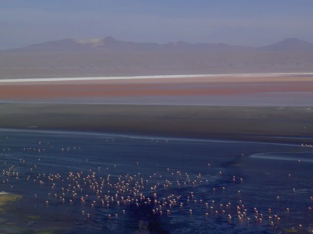
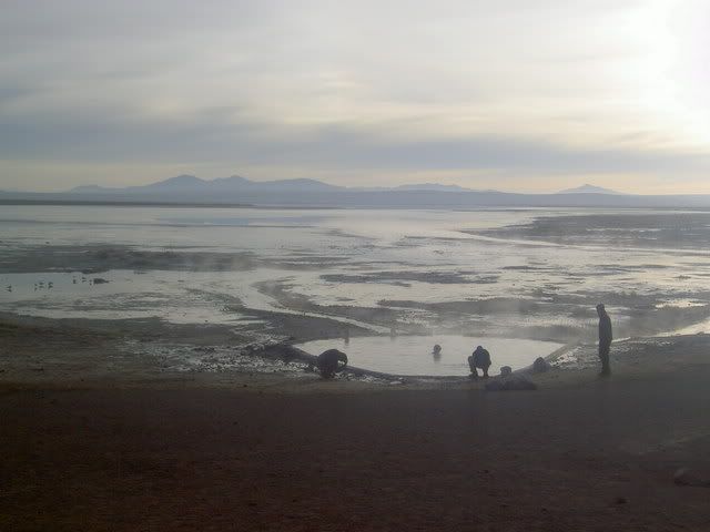
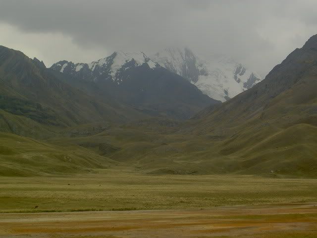
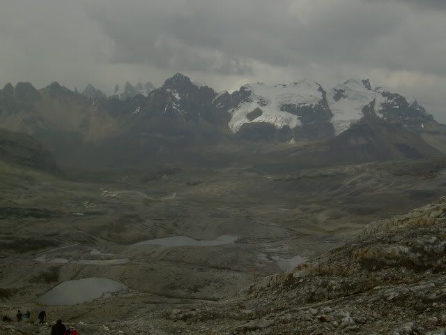
The second day of the tour we pased a series of lakes, all full of minerals and funny colors and flamingos, eventually passing through the Siloli desert (and its 'petrified tree') to the Laguna Colorada, or red lake, which strangely enough, is bright red in the middle. The third day we got up really early to catch the sunrise over some geysers (not worth it) and then spent an hour or so in a natural thermal bath on the edge of another lake (worth it, although it was freezing getting out and dry afterwards, still about 6am). After that we passed through the Dali Dessert to the Laguna Verde (green lake) where the reflextion of the volcano in the lake was amazing. The volcano as it happened marks the border with Chile, and about 30 minutes on from the lake we reached the line in the sand (literally) where a small shack and a burned out bus marked the frontier. Borders are pretty silly in general, and this one seemed particularly so, especially because at one point a war was fought between Chile and Bolivia over this bit of land (and the coastline) that is pretty much desolate...Chile just needed a couple more beaches I imagine.
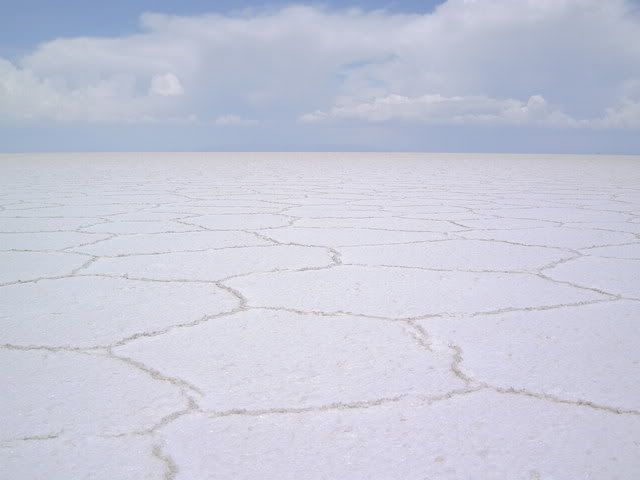
salar uyuni: not the place for a game of i spy
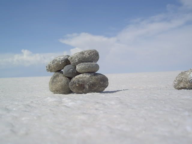
huge bolders or pebbles?
Bellavista sunrise
laguna colorada
thermal bath
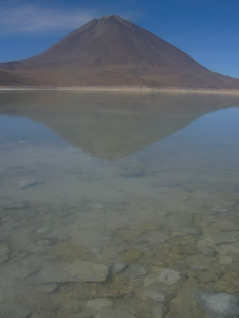
laguna verde
My trip started in Uyuni, I arrived at about 2am on a bus from Potosi, slept for a bit and then got up and booked a place in a Land Cruiser leaving that day. Uyuni used to be an important train stop for trainsfull of Bolivian minerals heading to Chile for export, but since the decline of the mining industy, tourism has taken over as its main economic lifeblood. And running 4x4s through the salt flats and across the deserts is the main attraction: sustainable? hardly, but there's no real alternative to see this crazy part of the world, somehow riding a bike across it doesnt appeal. The first day we drove through the salt flats to Isla Pescado, stopping for lunch and to take some silly perspective photos. Because there is nothing in the background its easy to manipulate the perpective and make it look like someone is standing on someone else's hand, being stepped on, or in my case, being smoked (i'm waiting for this photo to arrive via email still) making big stuff look small, or alternatley, small stuff look big (see below). We spent the night at a tiny community called Bellavista on a hill overlooking the Salar; at sunrise the next morning the town definatley lived up to its name.
The second day of the tour we pased a series of lakes, all full of minerals and funny colors and flamingos, eventually passing through the Siloli desert (and its 'petrified tree') to the Laguna Colorada, or red lake, which strangely enough, is bright red in the middle. The third day we got up really early to catch the sunrise over some geysers (not worth it) and then spent an hour or so in a natural thermal bath on the edge of another lake (worth it, although it was freezing getting out and dry afterwards, still about 6am). After that we passed through the Dali Dessert to the Laguna Verde (green lake) where the reflextion of the volcano in the lake was amazing. The volcano as it happened marks the border with Chile, and about 30 minutes on from the lake we reached the line in the sand (literally) where a small shack and a burned out bus marked the frontier. Borders are pretty silly in general, and this one seemed particularly so, especially because at one point a war was fought between Chile and Bolivia over this bit of land (and the coastline) that is pretty much desolate...Chile just needed a couple more beaches I imagine.
salar uyuni: not the place for a game of i spy
huge bolders or pebbles?
Bellavista sunrise
laguna colorada
thermal bath
laguna verde
Labels: geysers, salar uyuni, siloli
Tuesday, December 19, 2006
it´s all downhill from here
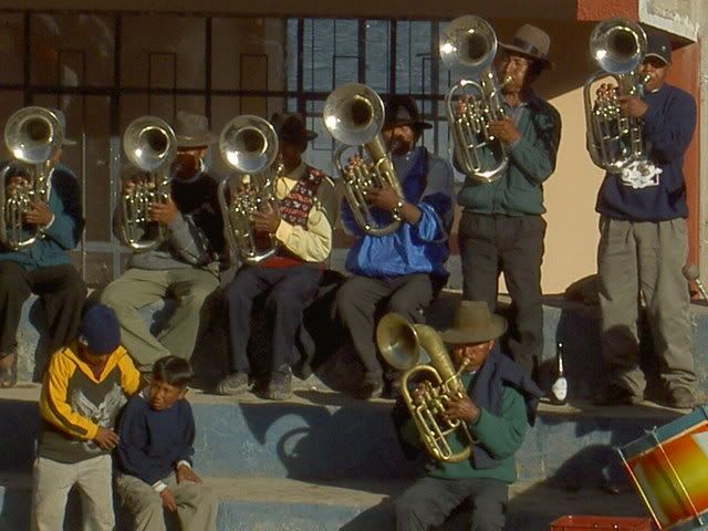
At 4000m above sea level, Potosí is the world´s highest city, but its real claim to fame, and raison d´etre, is the little hill called El Cerro Rico that sits just above the town. When the Spanish stumbled across a Quechua mining operation on the hill extracting huge amounts of silver they set up camp and turned Potosí, a middle of nowhere town too high for anything to grow, into the largest and most important city in South America. In its prime, it was bigger than London, Paris, or Madrid; producing 50% of the world´s silver it was the classic boomtown. The wealth came at a cost: about 6 million Indians died in the mines during the colonial area. Forced to work 48 hour shifts the miners´ life expectancy was the mid 30s. Coca leaves, initially outlawed by the church were relegalized when it was realized that miners didn´t need food or breaks during their marathon shifts if they were allowed to chew the leaves. A hybrid set of beliefs emerged in the mines, combining Quechua mythology and Catholicism; the two primary figures in this belief system are the Patchamama (mother earth) and El Tio (the devil). Miners make offerings of alchol (96proof sugarcane liquor is the standard), coca leaves, and cigarettes to the deities. While Patchamama is rarely personified, the entrance to each mine contains a statue of El Tio, complete with horns, cigarette in mouth, and huge erect penis. (for a fascinating analysis of all this see the second half of Michael Taussig´s The Devil and Commodity Fetishism in South America). Today the mountain is owned by the Bolvian State, although the state mine closed in the 80s. 37 Miners´ collectives work in the mountain, each rents a mine from the government and has the rights to anything it extracts, the profits from which is shared out between all the miners of the collective. Although the ownership is a bit more progressive than it was under the spanish and later the state, working conditions are still pretty medieval. Miners´ are responsible for their own safety, and the philosphy is dont take risks otherwise the mine will collapse. There is no formal training, new miners (aged 14-16) are taken under the wing of older ones who supervise them and show them the ropes. Work is specialized, so that one miner will spend an entire day (or even and entire working life) performing the same task. Helath precautions are limited to helmets and bandanas worn over the mouth, the life expectancy today is 55, retirement starts at 65. Silver is no longer the main mineral extracted, tin and zinc are more important, although there is still some silver production going on. The tour I took was run by one of the collectives, and the guides were exminers, money from tourism is helping to support the collectives and the community health center that sees a lot of action. What the miners must have thought seeing a bunch of gringos walking around a place they´d probably rather never go in is beyond me.
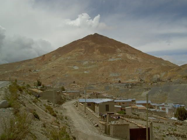
El Cerro Rico
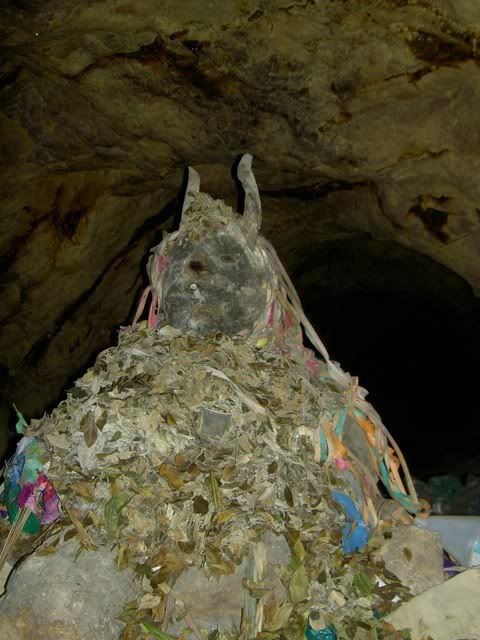
El Tio
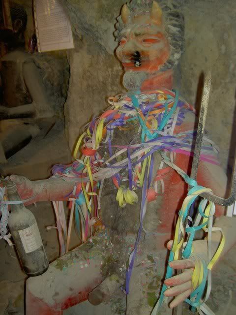
El Tio
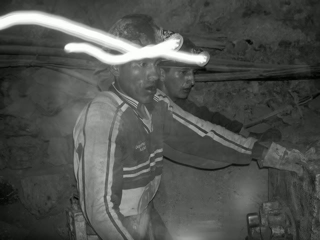
Mining
On a lighter Note: Daddy Yankee vs. The Poo Machine
Last night I had the pleasure of taking the night bus from Potosí to Uyuni. Crammed in the back corner (I waited too long to buy my ticket) for the ride along the bouncy rocky road I was thrilled to discover the driver in front in the baby in the back had arranged a decibel competition. Although Daddy Yankee had the edge in sheer volume, the baby´s edge in shrillness, piercingness, and startlingness won him the competition in the end. I realize that in the grand scheme of crimes against humanity, being a baby ought to be fairly forgivable, but last night that was a hard thought to entertain. ¡ME GUSTA LA GASOLINA! ¡DAME MAS GASOLINA!
El Cerro Rico
El Tio
El Tio
Mining
On a lighter Note: Daddy Yankee vs. The Poo Machine
Last night I had the pleasure of taking the night bus from Potosí to Uyuni. Crammed in the back corner (I waited too long to buy my ticket) for the ride along the bouncy rocky road I was thrilled to discover the driver in front in the baby in the back had arranged a decibel competition. Although Daddy Yankee had the edge in sheer volume, the baby´s edge in shrillness, piercingness, and startlingness won him the competition in the end. I realize that in the grand scheme of crimes against humanity, being a baby ought to be fairly forgivable, but last night that was a hard thought to entertain. ¡ME GUSTA LA GASOLINA! ¡DAME MAS GASOLINA!
Labels: daddy yankee, el tio, mining, potosi
Sunday, December 17, 2006
¡the most superlative filled post ever!
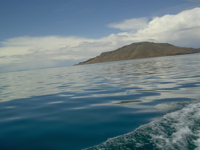
¡The World´s Highest Navegable Lake! -> Lake Titicaca
Early last wednesday morning I set sail with my new Swiss friend from the port of Puno (¡Peru´s ugliest city!) for the floating islands of the Uros. Built of reeds and mud, and tied together, these 45 or so islands float around Puno Bay attracting tourists. They were build during the Inca empire by the Uros, who wanted the empire to leave them alone. Today they are more or less floating souvenire stalls, as tourism is the only viable way of earning the cashmoney the people need to buy rice and potatoes from the mainland. Beacuse the reeds rot, everythign on the islands is rebuilt every 2 or 3 years, so it all looked really new, adding a bit to the disneyesque atmosphere. After a an hour or so around there we set off for the open lake and Isla Amantaní where we stayed with a local family and hiked up to the temple to the Pachamama (mother nature - ¡the most venerated deity in the andes!) to watch the sun go down. Island life seemed quite difficult; the fields where they said they grew potatos and quinua looked like quarries more than fields, and waiting for the rain was a perfectly acceptable way for the head of the family Nicolas to spend the day. There were almost no young people opn the island as as soon as they finish highschool (at 16-18 years old) most people hightail it to Lima or Arequipa to look for work, returning when they´re ready to settle down and start farming on the island. The same was true on Taquilla island which we visited the next day. The only source of income there being selling woven goods (the people there are recognized as ¡the world´s best weavers! by unicef) which are sold in a community run coop in the main plaza. The highlight of the trip was watching a party on Amantaní given in honor of the new mayor, where ¡the most drunk band in world! played musica del pueblo to about 200 people who held hands and ran around in a huge circle on the town´s basketabll court. wierd.
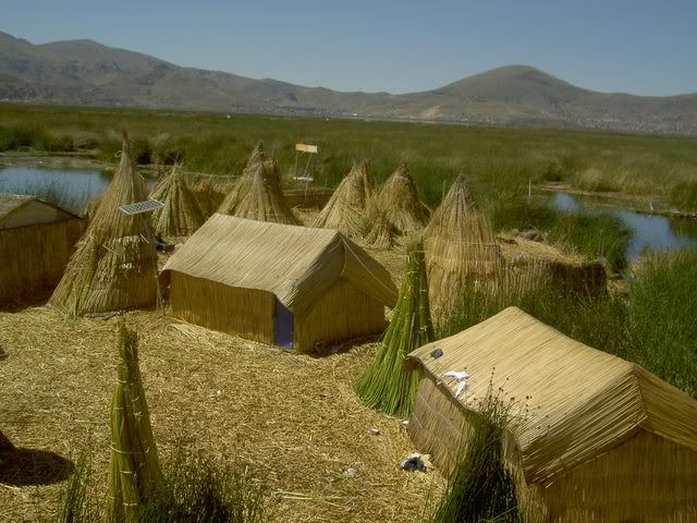
floating island, note the solar energy panel
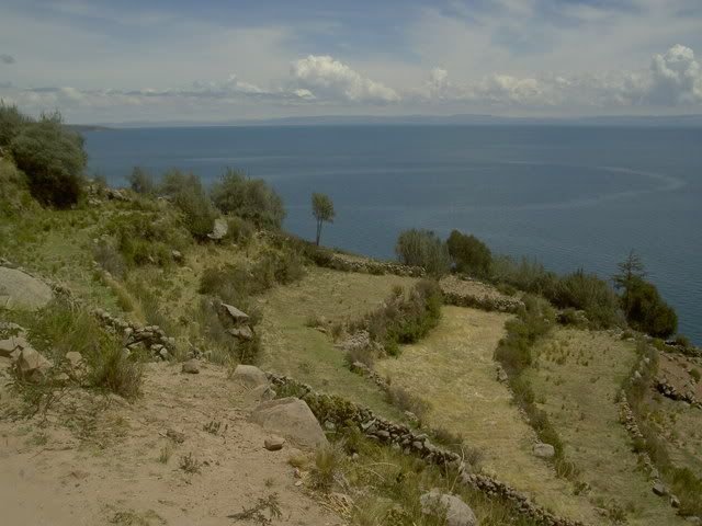
farms on amantaní
isla taquilla
banda del peublo
¡The World´s Highest Capitol City! -> La Paz, Bolivia
Like Sydney and Toronto, La Paz isnt technically the capitol city although everyone thinks it is. Unlike the other 2 though, most of Bolivia´s government has upped and moved to La Paz making it ¡the most de-facto capitol in the world! It´s a crazy busy place overflowing with markets and barley fitting into the valley it sits in. It doesnt actually fit anymore, and on the ridge above La Paz is El Alto, one of Latin America´s famous Barrios Jovenes full of recent (and almost all indigenous) immigrants to the city from the countryside. There are some pretty plaza spread around the city and since there is much less hassle directed toward tourists than in Peru, its easy to sit and enjoy them. On the way into the city from Lake Titicaca the bus passed over miles and miles of the high Altiplano, where all the wall were covered with propaganda for Evo Morales and his Movimiento Al Socialismo party. He enjoys huge popularity in this part of the country, and while Santa Cruz in the south was having a protest against his government looking for political and economic autonomy, La Paz held a counterprotest supporting Morales and his plan to rewrite the constitution.
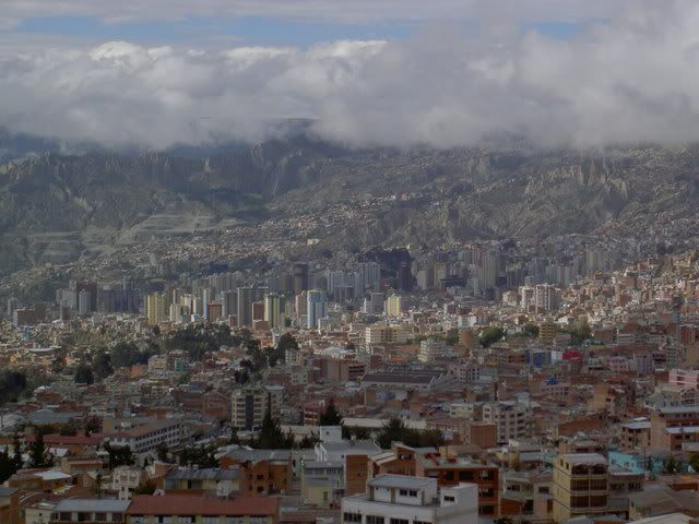
La Paz
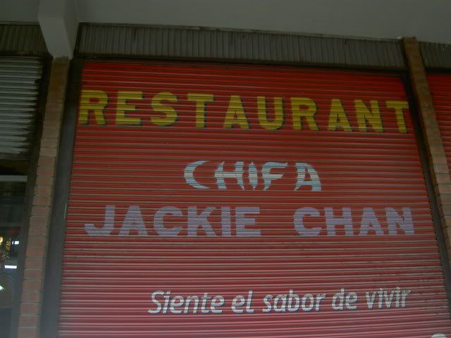
¡the best named chinese resturant ever!
¡The World´s Most Dangerous Road! -> La Paz to Coroico
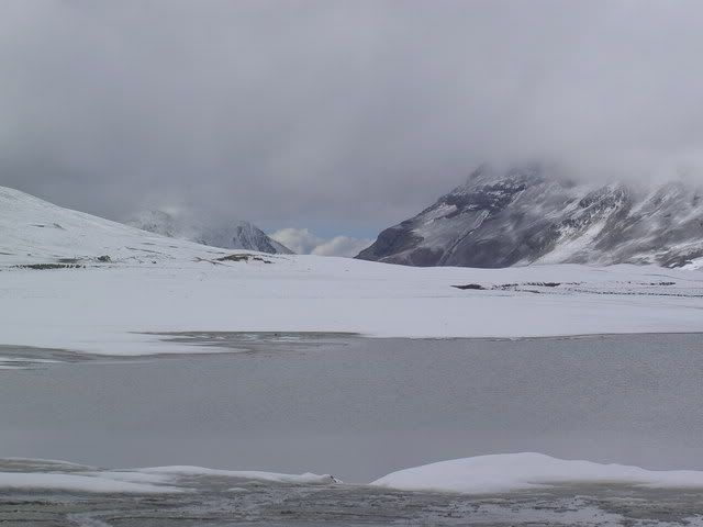
The road from La Paz to Coroico (and onto the Yungas valleys ¡the most coca producing part of the world!) is about 1 car wide, gravel and mud, and perched on an erroding ledge with sheer drops off to one side). It descends over 4000meters from a peak above La Paz (complete with snow) down into the steamy semi-jungle valleys around Coroico. Until a new road was built to replace it, it was the only way between the two cities, and buses, trucks, and cars would ride up and down it, passing on blind corners, getting stuck in traffic jams, and falling of the edge at a terrifying rate; hence the title as the world´s most dangerous road. Today there isnt much traffic as the new road is paved and wide and has guardrails, so its pretty much safe for downhill bike riding. From La Cumbre the group of us descended down a paved road, out of the snowy peaks, through a high alpinestyle valley, and over a ridge to the start of the ¡¡death road!! itself. Tour agencies definatley play up the death danger doom angle, but even so, the ride down the gravel road was a crazy rush. Down and down and down (around 70km in total) with a cliff on one side and a cliff on the other. Knowing my tendancy to fall of bikes, maybe i´m quite lucky to be posting this, but it never felt that scary. Once we got to Coroico we rode up to hotel esmerlda to take ¡the world´s most refreshing shower! After a lunch, we got in a van and drove back up the new road to La Paz, it took about as long to get up in the car as it had to get down by bike.
the start, la cumbre
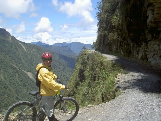
our guide and the road
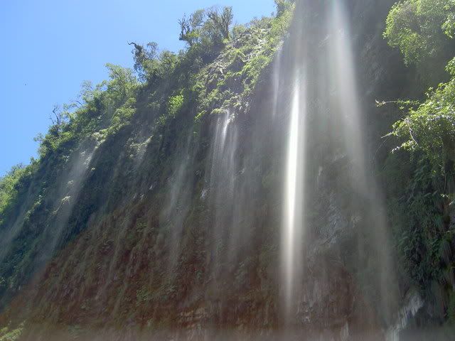
waterfall
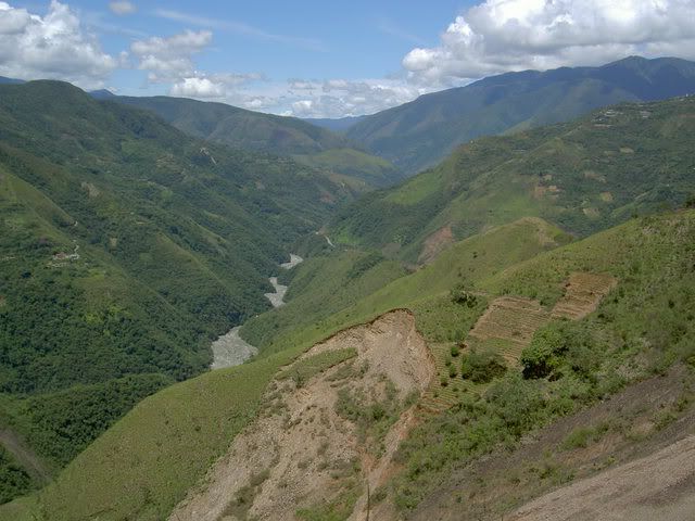
from the road of death toward las yungas
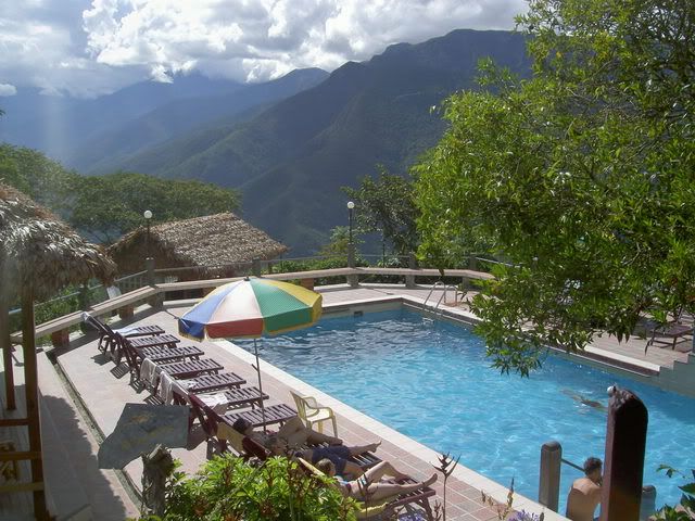
hotel esmeralda, bling bling!
cloudy mountains on the way back up
Early last wednesday morning I set sail with my new Swiss friend from the port of Puno (¡Peru´s ugliest city!) for the floating islands of the Uros. Built of reeds and mud, and tied together, these 45 or so islands float around Puno Bay attracting tourists. They were build during the Inca empire by the Uros, who wanted the empire to leave them alone. Today they are more or less floating souvenire stalls, as tourism is the only viable way of earning the cashmoney the people need to buy rice and potatoes from the mainland. Beacuse the reeds rot, everythign on the islands is rebuilt every 2 or 3 years, so it all looked really new, adding a bit to the disneyesque atmosphere. After a an hour or so around there we set off for the open lake and Isla Amantaní where we stayed with a local family and hiked up to the temple to the Pachamama (mother nature - ¡the most venerated deity in the andes!) to watch the sun go down. Island life seemed quite difficult; the fields where they said they grew potatos and quinua looked like quarries more than fields, and waiting for the rain was a perfectly acceptable way for the head of the family Nicolas to spend the day. There were almost no young people opn the island as as soon as they finish highschool (at 16-18 years old) most people hightail it to Lima or Arequipa to look for work, returning when they´re ready to settle down and start farming on the island. The same was true on Taquilla island which we visited the next day. The only source of income there being selling woven goods (the people there are recognized as ¡the world´s best weavers! by unicef) which are sold in a community run coop in the main plaza. The highlight of the trip was watching a party on Amantaní given in honor of the new mayor, where ¡the most drunk band in world! played musica del pueblo to about 200 people who held hands and ran around in a huge circle on the town´s basketabll court. wierd.
floating island, note the solar energy panel
farms on amantaní
isla taquilla
banda del peublo
¡The World´s Highest Capitol City! -> La Paz, Bolivia
Like Sydney and Toronto, La Paz isnt technically the capitol city although everyone thinks it is. Unlike the other 2 though, most of Bolivia´s government has upped and moved to La Paz making it ¡the most de-facto capitol in the world! It´s a crazy busy place overflowing with markets and barley fitting into the valley it sits in. It doesnt actually fit anymore, and on the ridge above La Paz is El Alto, one of Latin America´s famous Barrios Jovenes full of recent (and almost all indigenous) immigrants to the city from the countryside. There are some pretty plaza spread around the city and since there is much less hassle directed toward tourists than in Peru, its easy to sit and enjoy them. On the way into the city from Lake Titicaca the bus passed over miles and miles of the high Altiplano, where all the wall were covered with propaganda for Evo Morales and his Movimiento Al Socialismo party. He enjoys huge popularity in this part of the country, and while Santa Cruz in the south was having a protest against his government looking for political and economic autonomy, La Paz held a counterprotest supporting Morales and his plan to rewrite the constitution.
La Paz
¡the best named chinese resturant ever!
¡The World´s Most Dangerous Road! -> La Paz to Coroico
The road from La Paz to Coroico (and onto the Yungas valleys ¡the most coca producing part of the world!) is about 1 car wide, gravel and mud, and perched on an erroding ledge with sheer drops off to one side). It descends over 4000meters from a peak above La Paz (complete with snow) down into the steamy semi-jungle valleys around Coroico. Until a new road was built to replace it, it was the only way between the two cities, and buses, trucks, and cars would ride up and down it, passing on blind corners, getting stuck in traffic jams, and falling of the edge at a terrifying rate; hence the title as the world´s most dangerous road. Today there isnt much traffic as the new road is paved and wide and has guardrails, so its pretty much safe for downhill bike riding. From La Cumbre the group of us descended down a paved road, out of the snowy peaks, through a high alpinestyle valley, and over a ridge to the start of the ¡¡death road!! itself. Tour agencies definatley play up the death danger doom angle, but even so, the ride down the gravel road was a crazy rush. Down and down and down (around 70km in total) with a cliff on one side and a cliff on the other. Knowing my tendancy to fall of bikes, maybe i´m quite lucky to be posting this, but it never felt that scary. Once we got to Coroico we rode up to hotel esmerlda to take ¡the world´s most refreshing shower! After a lunch, we got in a van and drove back up the new road to La Paz, it took about as long to get up in the car as it had to get down by bike.
the start, la cumbre
our guide and the road
waterfall
from the road of death toward las yungas
hotel esmeralda, bling bling!
cloudy mountains on the way back up
Labels: floating islands, la paz, lake titicaca, puno, road of death, yungas
Monday, December 11, 2006
these boots were made for walking...
...and thats just what they did.
El Camino Inca to Machu Picchu
Day 1.
From Cusco, a bus took us down into the Sacred Valley, through Ollantaytambo, and on to km82 of the Inca Trail where the 4 day walk begins. There were four of us gringos, a guide, and 5 porters, who carried the tents, kitchen, and food. The first day´s hike was pretty gentle, a slow rise of 600m spread over 4 hours walking. We walked past Llaqtapata, a ruin discovered after Machu Picchu on the bank of the Urubamba river, and once we got to Wayllabamba we settled in for the evening. This was were I got the first impression of how amazing the porters were; as we ambled (the pace of the walk was never very quick) along the trail chatting, they ran, carrying huge bags upto 40 pounds, and some of them (from other groups) wearing only thin leather sandals on their feet. By the time we got to the campsite, the tents had already been set up, and they were hanging out listening to their radio and eating popcorn. It felt strange having people basically carry my shit for me, but without it, the whole trek would be impossible, or at least not very enjoyable. Juan Carlos, one of the porters told me that they usually do the trail 3 or 4 times a month to make some cash and spend the rest of their time working on the farms in their community (they were all from the same small town south of the sacred valley).
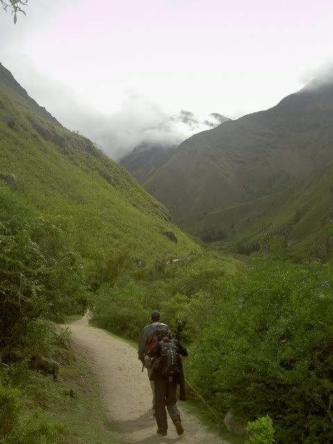
the start of the trail
llaqtapata
Day 2.
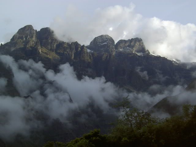
The second day included the hardest climb of the trek: up to the Dead Woman's Pass at 4200m above sea level. From the campsite it was about 2-3 hours up the increasingly steep trail/staircase. As the altitiude increased, we moved out of the subtropical cloud forest up into high andean grasslands. Occaisonally, with breaks in the clouds and fog, snowy peaks from the neighboring ranges poked through, making the climb more dramatic. After the pass, there was a long stairway down the other side following a small river/waterfall down to the second campsite. Coming into the trek, I'd heard that this was the most demanding and draining section, the long steep climb followed by the almost as difficuly descent. I felt ok at the top of the pass, maybe just a bit out of breath a sweaty, but my heart wasnt pounding too hard and my legs werent trembling. Maybe the mouthfuls of coca leaves helped afterall? People in the andes chew coca leaves to help deal with the altitude; the plant also helps to stave off hunger and settles the stomach. During the Inca empire it was crucial for the functioning of the network of chaskis or messengers who would carrry messages (encoded in tied strings called quipus) along the breadth of the Inca empire, at its peak stretcing from central Chile to southern Columbia. The messangers would run 50-60kms a day, carrying the messages they couldnt understand. Last year, in a race between the porters, a new record was set on the Inca trail when one ran the 42km (a marathon length) up and down the mountains to Machu Picchu in 3h45m, the walk that I did in 3.5 days or so.
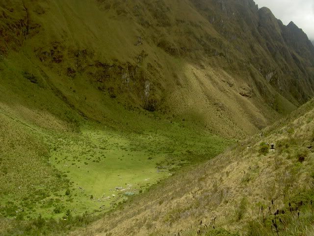
the valley leading up to the dead woman's pass
looking down from dead woman's pass
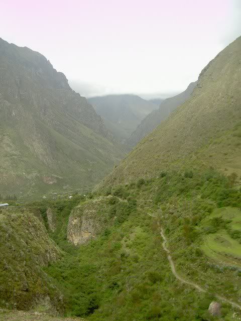
Day 3.
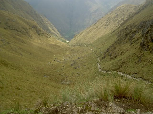
Normally the third day of the trek is the most beautiful, as the trail passes through 2 more high passes and along the side of a series of mountains, giving views of the spectacular valleys and ranges all around. Unfortunately, it was foggy all morning, and poured from 12 onwards, so this was the least pleasant section. Early in the day we passed the egg shaped ruin of runquracay, a resting place for chaskis and pilgrims heading to Machu Picchu. After a long wet hike up and down the 2 passes, we reached the campsite, and a few minutes later the skies cleared showing us what we'd been missing all day. By nighttime it was perfectly clear, and the nightsky was lit up by thousands of stars...a few of the shooting. But we couldnt stay up too late stargazing, since the next day was a 4am wake up call for the final leg through the sun gate into Machhu Picchu itself.
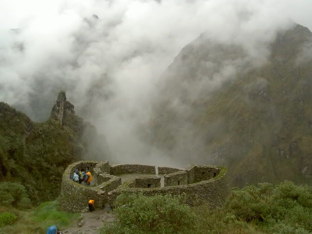
runkuraqay
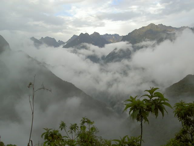
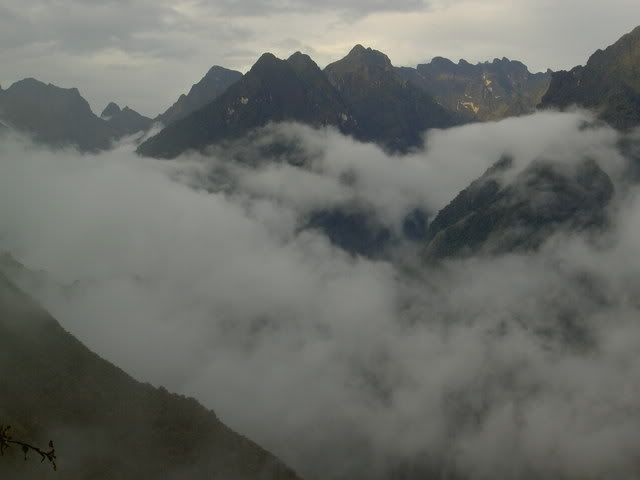
mountains in the mist, from the campsite in the early evening
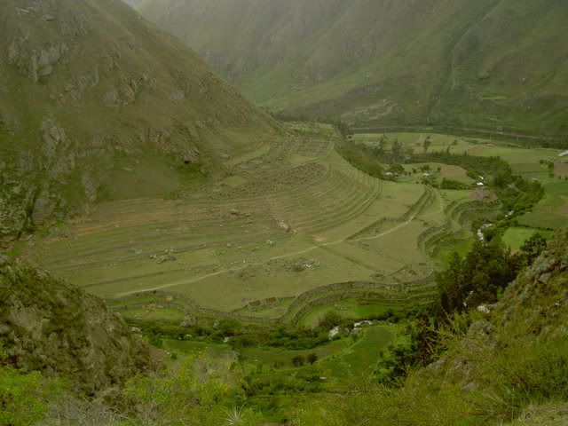
Day 4.
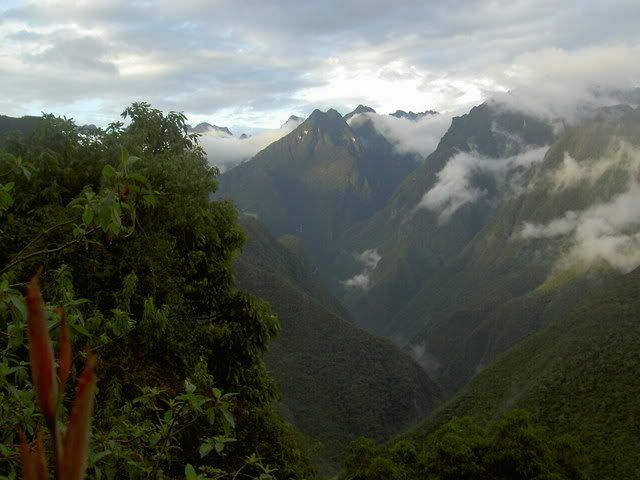
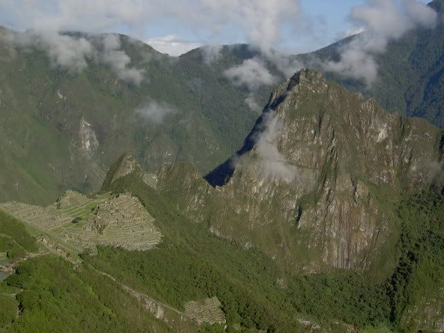
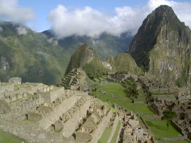
A bright and early start got us to Intipunku, or the sun gate, at about 6am. This was the principal enterance to Machu Pichu for pilgrims, commercial traffic followed the river along the bottom of the valley. The high route, that we took, was the one used by pilgrims who saw the Inca trail as a path to spiritual improvement. Many of the ruins along the trail feature fountains where the pilgrims would take purifiying showers. From the sungate, Machu Picchu is sprawled out below. A 40 minute descent later, we arrived and wandered around the site learning about its temples, its class based spacial divisions, and its importance as a ceremonial center for the Incas. Afterwards, we rode a bus down the valley floor, and rode the train back into Cusco, the return trip abour 3hours for the 4 days of walking to get there. But, despite the rainy sunday, it was definatley worthwhile...the views, the sites, and the feeling of accomplishment more than made up for being a bit soggy.
machu picchu from the sungate
machu picchu and huayna pichu
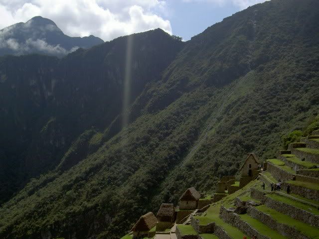
from macchu pichu towards the sun gate (on the 1st ridge), high on the 2nd ridge is one of the passes from the 3rd day.
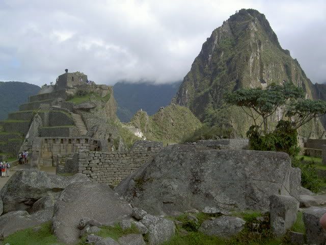
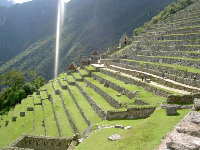
machu pichu
More Pictures Here
El Camino Inca to Machu Picchu
Day 1.
From Cusco, a bus took us down into the Sacred Valley, through Ollantaytambo, and on to km82 of the Inca Trail where the 4 day walk begins. There were four of us gringos, a guide, and 5 porters, who carried the tents, kitchen, and food. The first day´s hike was pretty gentle, a slow rise of 600m spread over 4 hours walking. We walked past Llaqtapata, a ruin discovered after Machu Picchu on the bank of the Urubamba river, and once we got to Wayllabamba we settled in for the evening. This was were I got the first impression of how amazing the porters were; as we ambled (the pace of the walk was never very quick) along the trail chatting, they ran, carrying huge bags upto 40 pounds, and some of them (from other groups) wearing only thin leather sandals on their feet. By the time we got to the campsite, the tents had already been set up, and they were hanging out listening to their radio and eating popcorn. It felt strange having people basically carry my shit for me, but without it, the whole trek would be impossible, or at least not very enjoyable. Juan Carlos, one of the porters told me that they usually do the trail 3 or 4 times a month to make some cash and spend the rest of their time working on the farms in their community (they were all from the same small town south of the sacred valley).
the start of the trail
llaqtapata
Day 2.
The second day included the hardest climb of the trek: up to the Dead Woman's Pass at 4200m above sea level. From the campsite it was about 2-3 hours up the increasingly steep trail/staircase. As the altitiude increased, we moved out of the subtropical cloud forest up into high andean grasslands. Occaisonally, with breaks in the clouds and fog, snowy peaks from the neighboring ranges poked through, making the climb more dramatic. After the pass, there was a long stairway down the other side following a small river/waterfall down to the second campsite. Coming into the trek, I'd heard that this was the most demanding and draining section, the long steep climb followed by the almost as difficuly descent. I felt ok at the top of the pass, maybe just a bit out of breath a sweaty, but my heart wasnt pounding too hard and my legs werent trembling. Maybe the mouthfuls of coca leaves helped afterall? People in the andes chew coca leaves to help deal with the altitude; the plant also helps to stave off hunger and settles the stomach. During the Inca empire it was crucial for the functioning of the network of chaskis or messengers who would carrry messages (encoded in tied strings called quipus) along the breadth of the Inca empire, at its peak stretcing from central Chile to southern Columbia. The messangers would run 50-60kms a day, carrying the messages they couldnt understand. Last year, in a race between the porters, a new record was set on the Inca trail when one ran the 42km (a marathon length) up and down the mountains to Machu Picchu in 3h45m, the walk that I did in 3.5 days or so.
the valley leading up to the dead woman's pass
looking down from dead woman's pass
Day 3.
Normally the third day of the trek is the most beautiful, as the trail passes through 2 more high passes and along the side of a series of mountains, giving views of the spectacular valleys and ranges all around. Unfortunately, it was foggy all morning, and poured from 12 onwards, so this was the least pleasant section. Early in the day we passed the egg shaped ruin of runquracay, a resting place for chaskis and pilgrims heading to Machu Picchu. After a long wet hike up and down the 2 passes, we reached the campsite, and a few minutes later the skies cleared showing us what we'd been missing all day. By nighttime it was perfectly clear, and the nightsky was lit up by thousands of stars...a few of the shooting. But we couldnt stay up too late stargazing, since the next day was a 4am wake up call for the final leg through the sun gate into Machhu Picchu itself.
runkuraqay
mountains in the mist, from the campsite in the early evening
Day 4.
A bright and early start got us to Intipunku, or the sun gate, at about 6am. This was the principal enterance to Machu Pichu for pilgrims, commercial traffic followed the river along the bottom of the valley. The high route, that we took, was the one used by pilgrims who saw the Inca trail as a path to spiritual improvement. Many of the ruins along the trail feature fountains where the pilgrims would take purifiying showers. From the sungate, Machu Picchu is sprawled out below. A 40 minute descent later, we arrived and wandered around the site learning about its temples, its class based spacial divisions, and its importance as a ceremonial center for the Incas. Afterwards, we rode a bus down the valley floor, and rode the train back into Cusco, the return trip abour 3hours for the 4 days of walking to get there. But, despite the rainy sunday, it was definatley worthwhile...the views, the sites, and the feeling of accomplishment more than made up for being a bit soggy.
machu picchu from the sungate
machu picchu and huayna pichu
from macchu pichu towards the sun gate (on the 1st ridge), high on the 2nd ridge is one of the passes from the 3rd day.
machu pichu
More Pictures Here
Labels: cusco, inca trail, machu picchu, sacred valley
Wednesday, December 06, 2006
location, location, location!
If the Incas knew one thing, and it seems like they knew a great deal, they knew the fundamentals of real-estate. The Sacred Valley of the Incas must be one of the most amazingly breathtaking places on earth, and its not just the altitude. The 19th century historian of the Incas, Sir Clements Markham wrote that "the wide world might be searched without finding a rival, in enchanting beauty, to the Sacred Valley of the Incas" and he could be right...in any case its a search I'd willingly take up if anyone is hiring for that sort of thing.
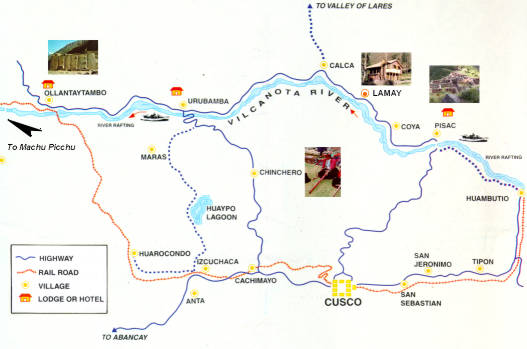
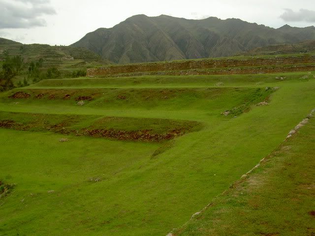
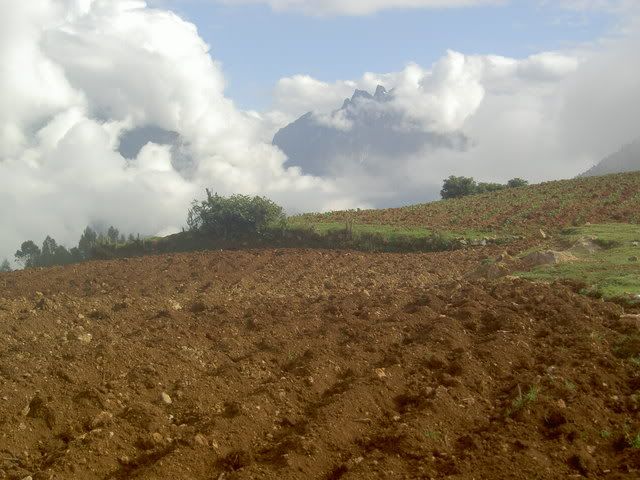
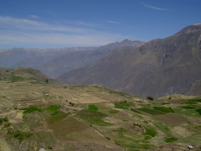
After an extensive searched, I came across what could be the only road bike in southern Peru: a foxy old red Bianchi track bike...that was a tad small for me. So, after 2 days in the saddle alternately racing and crawling through the Sacred Valley, my shoulders are a bit on the sore side. From Cusco, its about 13km uphill to Tambomachay, an Incan ruin on the ridge of the hills that form the Valley of Cusco. Once I got to the ridge, I didnt have to peddle again for 18km all the way down to Pisaq. The descent from Tambomachay to Pisaq has to be the most beautiful, surprising, and terrifying ride I've ever done. The temptation to look at the view was tempered by the hairpin turns and the potholes, not all that many, but big enough to contain their own Inca ruins. At everyturn a new set of hills showed themselves, and at each of 3 towns I thought this must be it, time to peddle again, but the hill kept going and going.
Once I got to Pisaq I stopped to look around the small market in the town square and get some breakfast: bananas and water. From Pisaq, I followed the floor of the valley alongside the Vilcanota River. A slow and steady descent to the town of Urubamba. On my right, green hills rose up and then turned steep, leading up to rocky peaks, behind them, in the breaks in the clouds I could occaisonally see the snow capped mountains of the ridge behind, that form the walls of the Valley de Lares. On my left, fields, the river, more fields, and then sheer cliffs up to the plateau between the peaks on that side and the valley below. Behind and in front of me, the road, used to herd sheep, llamas, pigs and donkeys from pasture to pasture, leading eventually to Machu Picchu. I caught a bus up the left hand side of the valley from Urubamba to Chinchero, where I spent the night. Chincero is named after a palace built there as a retirement home by one of the first Incas...beats Florida for damn sure.
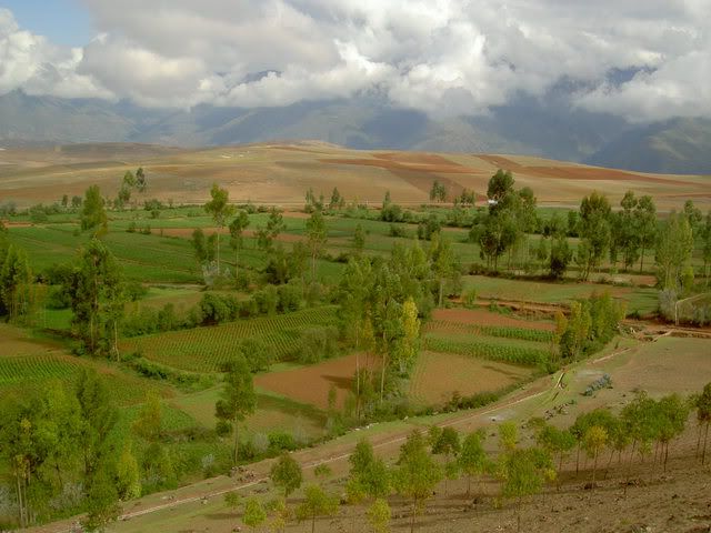
The next day, I headed back down towards Urubamba, enjoying the rolling hills of the high plateau. Before I got to the steep windy descent to the valley floor I veered of the left to the towns of Maras and Moray where there are (surprise!) more Incan ruins. After looking around there, I headed back to Cusco, which involved climbing back up the backside of the ridge to get into the Valley of Cusco. Eventually I crossed the last ridge and saw Cusco laid out below me, Sacsayhuaman and the White Christ Statue of to my left, the Plaza de Armas just underneath me. The ride down through the hillside suburbs was like a video game; I was faster than the slow trucks and buses riding their brakes down the hill, and I had to pick the oportune moments to swing past them and get back over to the right. After about 13 switchbacks I got down to the colonial city, where the road turns to cobblestone and I was forced to dismount and walk my way back through town to where I returned the bike.
Most importantly, I learned two techniques for preventing dog attacks:
1. going downhill => as a dog runs onto the road toward you slow down. It alters its route and comes right at you from the side (they're usually coming from in front and to the side of you), once the dog gets within a bodylength of you, let go of the breaks, and peddle like crazy. The dog can't change its route quick enough, and usually falls over, by the time it figures out whats up, you're flying down the hill, long gone...
2. going flat or uphill => in this case, dogs can approach from all sides, but the technique works the same...get over to the side of the road, and dismount. keep the bike between you and the dog. stop and look at it. it will stop running at you at least. If it keeps barking, or wont go away, swoop down to pick up a rock (even if there arent any rocks, pretend: to dog doesnt know the difference, and recognizes the swoop as a signal that a rock is about to get thrown at it). if they dont stop, throw the rock. repeat.
both techniques worked and kept this ride rabies free.
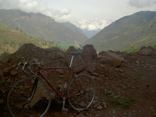
my bike, the sacred valley
the valley from tambomachay to pisaq
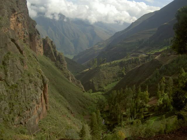
the sacred valley from above
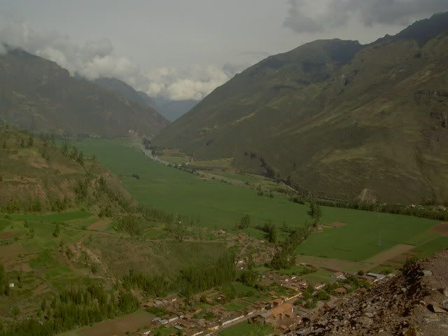
from the bottom
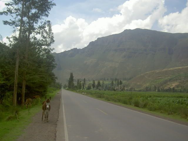
part of the chinchero ruin
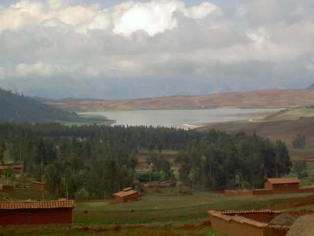
the plateau around chinchero
for more pcitures, click the purty pictures link on the left.
After an extensive searched, I came across what could be the only road bike in southern Peru: a foxy old red Bianchi track bike...that was a tad small for me. So, after 2 days in the saddle alternately racing and crawling through the Sacred Valley, my shoulders are a bit on the sore side. From Cusco, its about 13km uphill to Tambomachay, an Incan ruin on the ridge of the hills that form the Valley of Cusco. Once I got to the ridge, I didnt have to peddle again for 18km all the way down to Pisaq. The descent from Tambomachay to Pisaq has to be the most beautiful, surprising, and terrifying ride I've ever done. The temptation to look at the view was tempered by the hairpin turns and the potholes, not all that many, but big enough to contain their own Inca ruins. At everyturn a new set of hills showed themselves, and at each of 3 towns I thought this must be it, time to peddle again, but the hill kept going and going.
Once I got to Pisaq I stopped to look around the small market in the town square and get some breakfast: bananas and water. From Pisaq, I followed the floor of the valley alongside the Vilcanota River. A slow and steady descent to the town of Urubamba. On my right, green hills rose up and then turned steep, leading up to rocky peaks, behind them, in the breaks in the clouds I could occaisonally see the snow capped mountains of the ridge behind, that form the walls of the Valley de Lares. On my left, fields, the river, more fields, and then sheer cliffs up to the plateau between the peaks on that side and the valley below. Behind and in front of me, the road, used to herd sheep, llamas, pigs and donkeys from pasture to pasture, leading eventually to Machu Picchu. I caught a bus up the left hand side of the valley from Urubamba to Chinchero, where I spent the night. Chincero is named after a palace built there as a retirement home by one of the first Incas...beats Florida for damn sure.
The next day, I headed back down towards Urubamba, enjoying the rolling hills of the high plateau. Before I got to the steep windy descent to the valley floor I veered of the left to the towns of Maras and Moray where there are (surprise!) more Incan ruins. After looking around there, I headed back to Cusco, which involved climbing back up the backside of the ridge to get into the Valley of Cusco. Eventually I crossed the last ridge and saw Cusco laid out below me, Sacsayhuaman and the White Christ Statue of to my left, the Plaza de Armas just underneath me. The ride down through the hillside suburbs was like a video game; I was faster than the slow trucks and buses riding their brakes down the hill, and I had to pick the oportune moments to swing past them and get back over to the right. After about 13 switchbacks I got down to the colonial city, where the road turns to cobblestone and I was forced to dismount and walk my way back through town to where I returned the bike.
Most importantly, I learned two techniques for preventing dog attacks:
1. going downhill => as a dog runs onto the road toward you slow down. It alters its route and comes right at you from the side (they're usually coming from in front and to the side of you), once the dog gets within a bodylength of you, let go of the breaks, and peddle like crazy. The dog can't change its route quick enough, and usually falls over, by the time it figures out whats up, you're flying down the hill, long gone...
2. going flat or uphill => in this case, dogs can approach from all sides, but the technique works the same...get over to the side of the road, and dismount. keep the bike between you and the dog. stop and look at it. it will stop running at you at least. If it keeps barking, or wont go away, swoop down to pick up a rock (even if there arent any rocks, pretend: to dog doesnt know the difference, and recognizes the swoop as a signal that a rock is about to get thrown at it). if they dont stop, throw the rock. repeat.
both techniques worked and kept this ride rabies free.
my bike, the sacred valley
the valley from tambomachay to pisaq
the sacred valley from above
from the bottom
part of the chinchero ruin
the plateau around chinchero
for more pcitures, click the purty pictures link on the left.
Labels: bikes, cusco, peru, sacred valley
Saturday, December 02, 2006
notes from el sendero gringo: ecuador -> arequipa
the north coast
Crossing the border into Peru was the most stressful happening so far. Shifty 'guides', agressive moneychangers, and lying taxi drivers made the trip from Cuenca to Tumbes a hassle. But since then, Peru has offered mostly smooth sailing. The northern cities of Chiclayo and Trujillo are surrounded by desert, and pre-Incan ruins. For most of the journey, the ground was beige, but this was broken at intervals by patches of green rice paddies with knee deep water. The amount of irrigation involved in this project must be pretty intense. The craziest thing about the pre-Inca ruins (evidence of large scale civilizations and cities) is that the region has been producing food for centuries, and its not just modern technology that has rendered it fertile. The 2 sites I visited near Chiclayo have suffered a lot from the passing time and most closely resemble giant eroding termite hills. Archeaologists did find an impressive burial suit at one tomb, (of a high priest, soldier called Senor Sipan)...Huaca de la Luna (outside Trujillo - itself more impressive) was much better preserved, partly because of the custom of building one temple on top of the old one every 100 years, so the murals on the oldest temples have been protected by new walls. The temple was ransaked by Spaniards looking for gold, and so there is a huge cut through the middle of it.
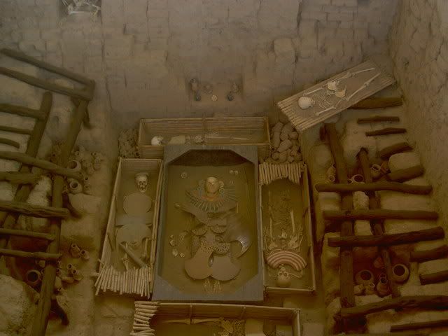
Senor Sipan's tomb
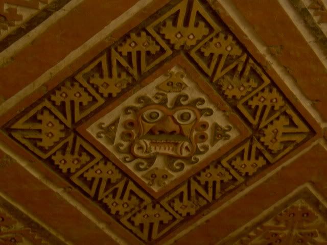
Mural at Huaca de la Luna
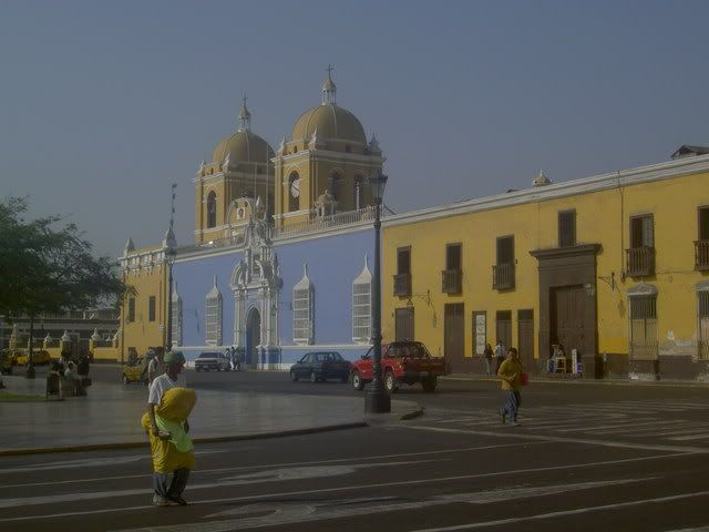
Trujillo Plaza de Armas
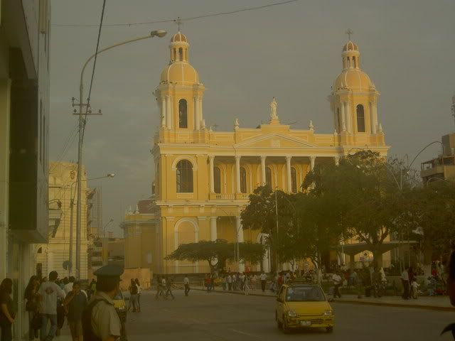
Chiclayo Plaza de Armas
la cordilera blanca
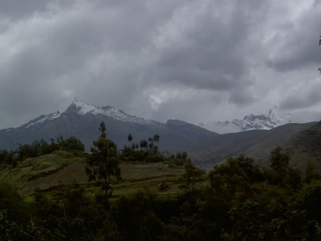
The town of Huaraz sits in a glacial valley just below Peru's most spectacular set of mountains: the Cordilera Blanca, a range of snow capped peaks shooting up to 6000+meters, including Peru's highest peak (the 2nd tallest in South America). At one end of the valley lies the (rapidly shrinking) glacier Pastoruri. The road up from Huaraz to the glacier passes through grasslands in the bottom of the valley inhabited by sheep, alpacas, and a wierd flower species that waits 35 years to flower then grows up 10m tall (sorry for the all metric, its whats they use here, and I cant convert). From the top of glacier (a slippery hike up) there were views of snowy mountains in all directions, but the afternoon clouds and rain were closing in, so I beat a hasty retreat. The next day I rented a bike and headed uphill. A very pleasant three hour ride up towards the cordilera blanca, through small rocky fields, indigenous communities, eucaliptus forests and eventually through high altitude pastures (4100m) ended abruptly when a dog ran out of a field barking, chasing, and eventually, biting. Nothing serious said the ladies at the clinic in Huaraz, not deep enough to give me rabies at least...deep enough to make me lose inhibitions about throwing rocks at dogs though. From the base of the mountians (where they start getting seriously steep) there was a long ride back down along a little gravel road with plenty of hairpins back to Huaraz. Before taking the night bus to Lima the next day, I tried something new: rock climbing. The rocky outcroppings around Huaraz offer good climbs for all levels, and I tried my luck on the easiest. Its a difficult sport, especially for the muscles in my arms that I dont think I'd ever used before...but it felt pretty good getting up a near vertical rock face...the instructor embarassed everyone afterwards by practically running up the climb to gather the chords and equipment.
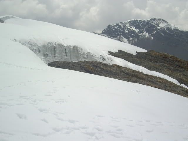
Pastoruri glacier
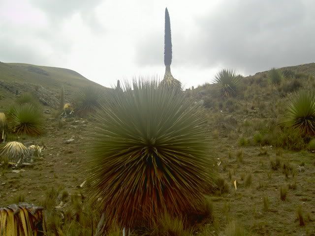
wierd flower
grasslands in the valley
view from the glacier
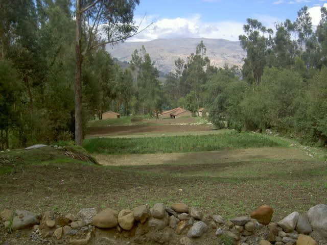
small farms from my bike ride
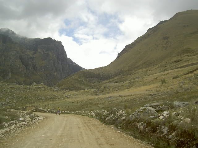
this is where i was when the dog bit...the gap in the mountains leads to a 12km trail to the cordilera proper
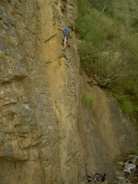
rock climbing
Lima
Lima gets a bad reputation, especially in Quito, but its mostly unfounded I think. Perhaps Quitenos are a tad jealous of the larger, hipper, oceanside city, and so spread stories of its out of control crime to keep people from visiting it, but besides from being pretty hectic, and having a bit more street hassle, Lima didn't feel vastly different from any other big South American city I've been to so far (and it was so much better than Guayaquil that to compare them would be silly). I only spent a day and half there, but it left me with a good taste in my mouth...there wasnt a whole lot 'to do' but it (especially the young lively miraflores neighborhood) like a very livable place with a lot 'going on'. The colonial center was pretty extensive, about 10 blocks by 5 blocks and had the usual cathedral, plaza de armas, and miriad churches...Miraflores is where Lima really sets itself apart. Perched on the cliffs overlooking the Pacific Ocean, this neighborhood, a 30 minute bus trip from the center, is home to most of Lima's 'high culture' theatres, galleries, movies etc...the buildings arent nice like in the center, but the street life is very energentic, with cafes sprawling practically all the way across the sidewalks into the street, parks, and quiter residential streets tucked in behind. pretty good.
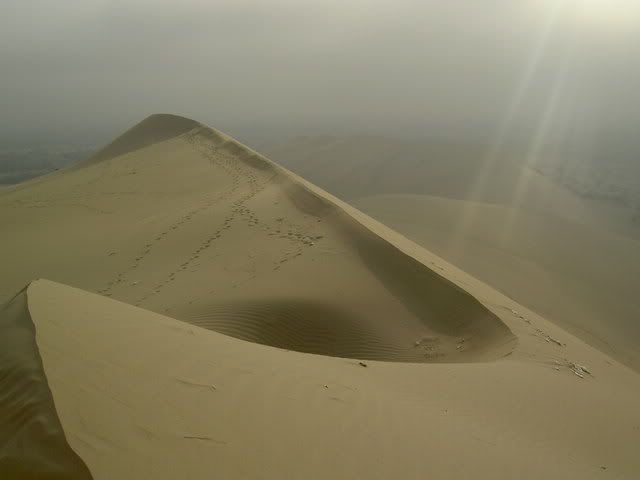
the south coast
South of Lima the desert continues. For hours. I got off the bus at the small oasis/resort town of Huacachina and spent the night. I got up early before the sun heated up the giant sand dunes flanking the town and tried my hand at sandboarding. Unlike a snowboard, a sandboard doesnt turn. Unlike snow, sand is hard. So after 1 run, I swtiched to sandsledding, much better. Deserts are crazy looking, especially with huge sand dunes. Next stop on the whirlwind tour of the south coast was Nasca home of the Nasca Lines...ancient doodles in the desert, (explained in my last post)...after a fly over the lines in a 4 seater plane (shotgun!) I spent the afternoon in Nasca's main plaza where most of Nasca seemed to be hanging out too. The town's planetarium had a lecture on explaining the lines (unconvincing) and after we got to look at the moon through a telescope. Sometimes when I say outloud or write what I've been doing in the last few weeks it sounds totally ridiculous...this is certainly an example.
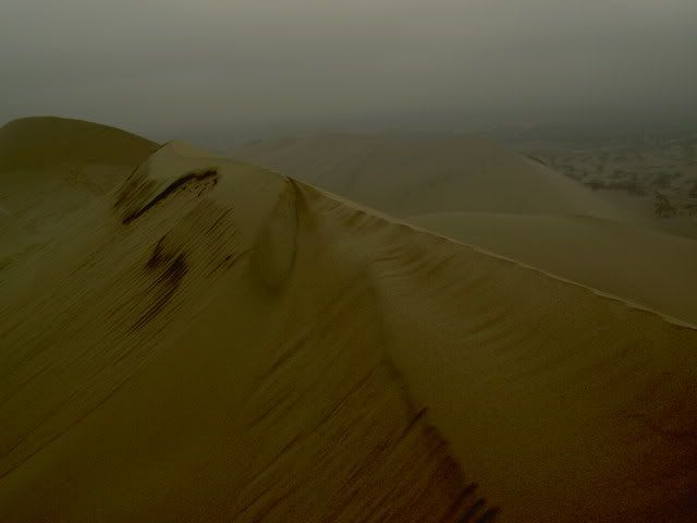
dunes
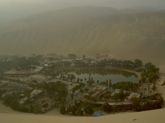
oasis
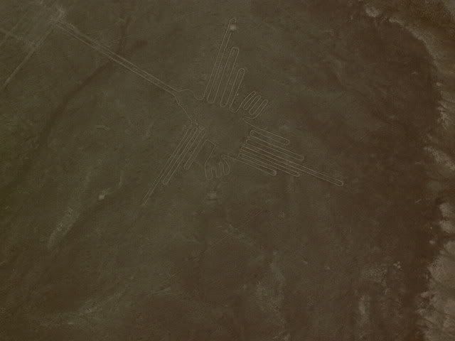
Nasca Lines hummingbird
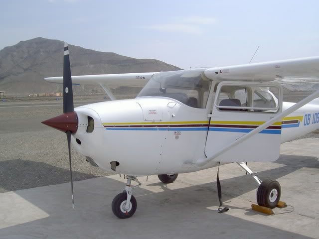
plane
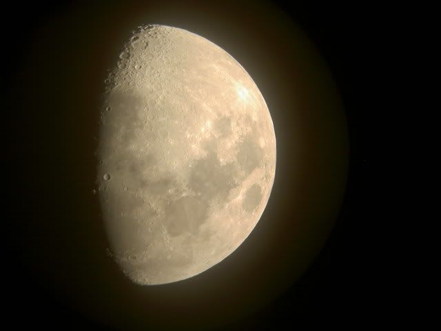
the moon
arequipa and the colca canyon
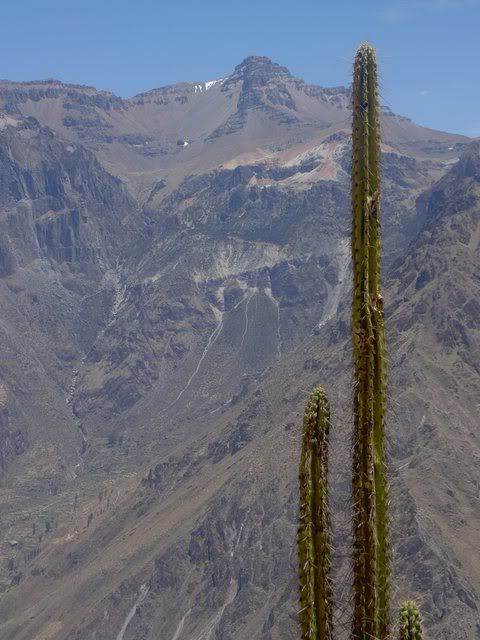
The Colca Canyon is the world's deepest, or so they say in these parts. Its pretty spectacular either way. Yesterday I caught the local bus at 6am to the lookout point Cruz del Condor where you're supposed to be able to see condors floating on the morning thermals coming out of the canyon. I saw one condor, and it cruized out of there pretty quick, whatever. After I walked along the canyon (its not a vertical drop like the grand canyon, its like 2 mountain ranges who're just next to each other, and the bottom pars of the mountains is the steepest, with a small plain about 2 thirds of the way up) to the village of Cabanaconde...it was really clear and sun was super intense, but it wasnt too hot...the walk was along the road for about 5 miles (3 cars passed total) and then along a small trail used as shortcut by herders from the village. I caught the bus back to Chivay (where i was staying) and nearly fell asleep over my dinner...the last few days had finally caught up, so I got an early night's sleep and slept in (until 8!!). The bus back to Arequipa (Peru's 2nd biggest city) passed through more desert and grassland where the South American Camel makes its home. The jagged rocky mountains on both sides made for a pretty trip, even if the equally rocky road made it a bouncy one. Arequipa has some of the nicest colonial style architecture in Peru and perhaps its most exquisite exemplar is the Santa Caralina Convent founded in the 16th century and going strong today. Its like a little city within the city, walled in in an entire city blocks, it has its own streets, courtyards, and churches...the walls are all painted bright red and blue...not a bad place to be a nun i'd say.
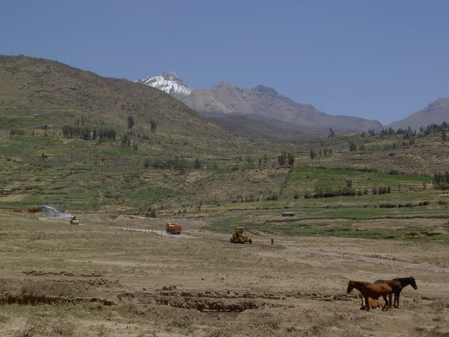
Colca Canyon
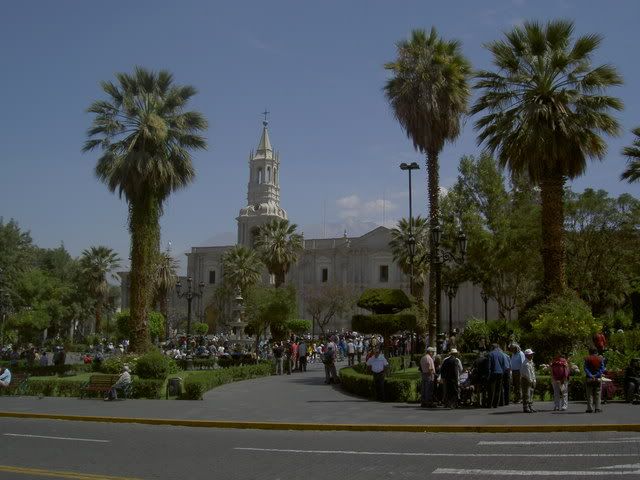
Arequipa Plaza de Armas
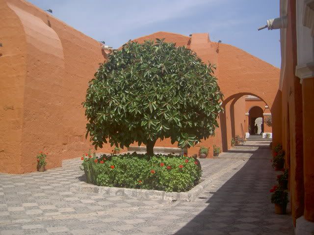
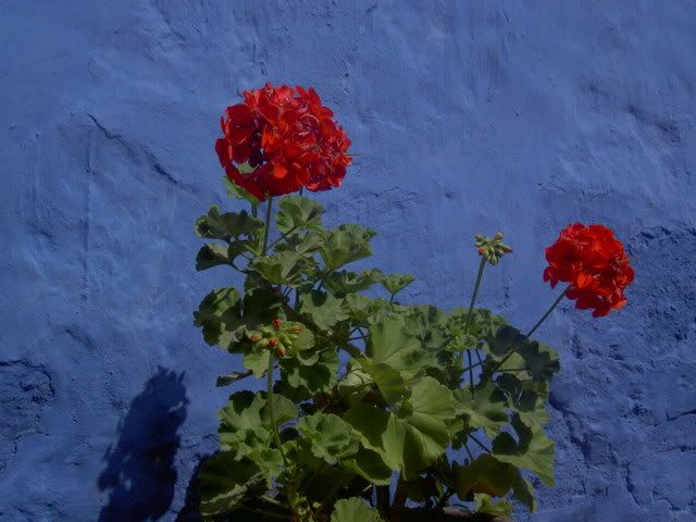
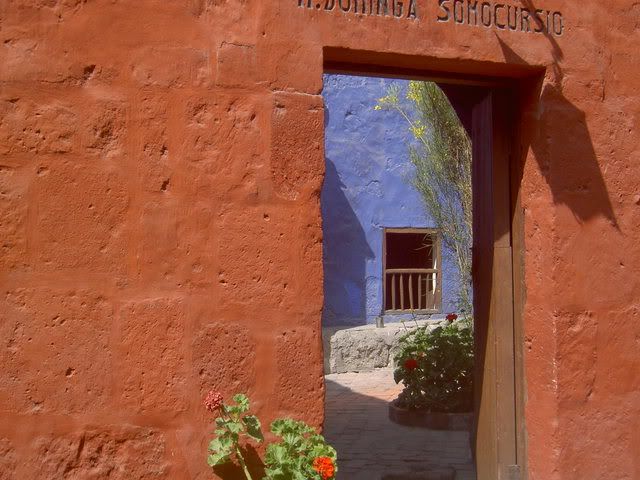
Santa Catalina Convent
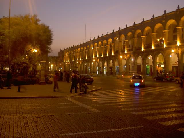
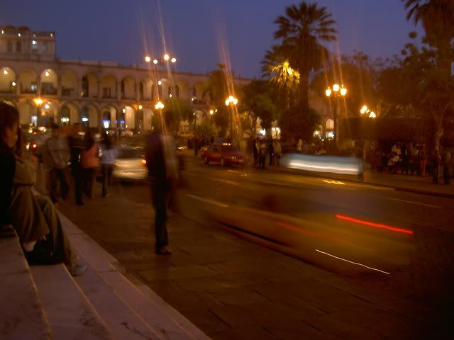
Arequipa - Saturday Night
Crossing the border into Peru was the most stressful happening so far. Shifty 'guides', agressive moneychangers, and lying taxi drivers made the trip from Cuenca to Tumbes a hassle. But since then, Peru has offered mostly smooth sailing. The northern cities of Chiclayo and Trujillo are surrounded by desert, and pre-Incan ruins. For most of the journey, the ground was beige, but this was broken at intervals by patches of green rice paddies with knee deep water. The amount of irrigation involved in this project must be pretty intense. The craziest thing about the pre-Inca ruins (evidence of large scale civilizations and cities) is that the region has been producing food for centuries, and its not just modern technology that has rendered it fertile. The 2 sites I visited near Chiclayo have suffered a lot from the passing time and most closely resemble giant eroding termite hills. Archeaologists did find an impressive burial suit at one tomb, (of a high priest, soldier called Senor Sipan)...Huaca de la Luna (outside Trujillo - itself more impressive) was much better preserved, partly because of the custom of building one temple on top of the old one every 100 years, so the murals on the oldest temples have been protected by new walls. The temple was ransaked by Spaniards looking for gold, and so there is a huge cut through the middle of it.
Senor Sipan's tomb
Mural at Huaca de la Luna
Trujillo Plaza de Armas
Chiclayo Plaza de Armas
la cordilera blanca
The town of Huaraz sits in a glacial valley just below Peru's most spectacular set of mountains: the Cordilera Blanca, a range of snow capped peaks shooting up to 6000+meters, including Peru's highest peak (the 2nd tallest in South America). At one end of the valley lies the (rapidly shrinking) glacier Pastoruri. The road up from Huaraz to the glacier passes through grasslands in the bottom of the valley inhabited by sheep, alpacas, and a wierd flower species that waits 35 years to flower then grows up 10m tall (sorry for the all metric, its whats they use here, and I cant convert). From the top of glacier (a slippery hike up) there were views of snowy mountains in all directions, but the afternoon clouds and rain were closing in, so I beat a hasty retreat. The next day I rented a bike and headed uphill. A very pleasant three hour ride up towards the cordilera blanca, through small rocky fields, indigenous communities, eucaliptus forests and eventually through high altitude pastures (4100m) ended abruptly when a dog ran out of a field barking, chasing, and eventually, biting. Nothing serious said the ladies at the clinic in Huaraz, not deep enough to give me rabies at least...deep enough to make me lose inhibitions about throwing rocks at dogs though. From the base of the mountians (where they start getting seriously steep) there was a long ride back down along a little gravel road with plenty of hairpins back to Huaraz. Before taking the night bus to Lima the next day, I tried something new: rock climbing. The rocky outcroppings around Huaraz offer good climbs for all levels, and I tried my luck on the easiest. Its a difficult sport, especially for the muscles in my arms that I dont think I'd ever used before...but it felt pretty good getting up a near vertical rock face...the instructor embarassed everyone afterwards by practically running up the climb to gather the chords and equipment.
Pastoruri glacier
wierd flower
grasslands in the valley
view from the glacier
small farms from my bike ride
this is where i was when the dog bit...the gap in the mountains leads to a 12km trail to the cordilera proper
rock climbing
Lima
Lima gets a bad reputation, especially in Quito, but its mostly unfounded I think. Perhaps Quitenos are a tad jealous of the larger, hipper, oceanside city, and so spread stories of its out of control crime to keep people from visiting it, but besides from being pretty hectic, and having a bit more street hassle, Lima didn't feel vastly different from any other big South American city I've been to so far (and it was so much better than Guayaquil that to compare them would be silly). I only spent a day and half there, but it left me with a good taste in my mouth...there wasnt a whole lot 'to do' but it (especially the young lively miraflores neighborhood) like a very livable place with a lot 'going on'. The colonial center was pretty extensive, about 10 blocks by 5 blocks and had the usual cathedral, plaza de armas, and miriad churches...Miraflores is where Lima really sets itself apart. Perched on the cliffs overlooking the Pacific Ocean, this neighborhood, a 30 minute bus trip from the center, is home to most of Lima's 'high culture' theatres, galleries, movies etc...the buildings arent nice like in the center, but the street life is very energentic, with cafes sprawling practically all the way across the sidewalks into the street, parks, and quiter residential streets tucked in behind. pretty good.
the south coast
South of Lima the desert continues. For hours. I got off the bus at the small oasis/resort town of Huacachina and spent the night. I got up early before the sun heated up the giant sand dunes flanking the town and tried my hand at sandboarding. Unlike a snowboard, a sandboard doesnt turn. Unlike snow, sand is hard. So after 1 run, I swtiched to sandsledding, much better. Deserts are crazy looking, especially with huge sand dunes. Next stop on the whirlwind tour of the south coast was Nasca home of the Nasca Lines...ancient doodles in the desert, (explained in my last post)...after a fly over the lines in a 4 seater plane (shotgun!) I spent the afternoon in Nasca's main plaza where most of Nasca seemed to be hanging out too. The town's planetarium had a lecture on explaining the lines (unconvincing) and after we got to look at the moon through a telescope. Sometimes when I say outloud or write what I've been doing in the last few weeks it sounds totally ridiculous...this is certainly an example.
dunes
oasis
Nasca Lines hummingbird
plane
the moon
arequipa and the colca canyon
The Colca Canyon is the world's deepest, or so they say in these parts. Its pretty spectacular either way. Yesterday I caught the local bus at 6am to the lookout point Cruz del Condor where you're supposed to be able to see condors floating on the morning thermals coming out of the canyon. I saw one condor, and it cruized out of there pretty quick, whatever. After I walked along the canyon (its not a vertical drop like the grand canyon, its like 2 mountain ranges who're just next to each other, and the bottom pars of the mountains is the steepest, with a small plain about 2 thirds of the way up) to the village of Cabanaconde...it was really clear and sun was super intense, but it wasnt too hot...the walk was along the road for about 5 miles (3 cars passed total) and then along a small trail used as shortcut by herders from the village. I caught the bus back to Chivay (where i was staying) and nearly fell asleep over my dinner...the last few days had finally caught up, so I got an early night's sleep and slept in (until 8!!). The bus back to Arequipa (Peru's 2nd biggest city) passed through more desert and grassland where the South American Camel makes its home. The jagged rocky mountains on both sides made for a pretty trip, even if the equally rocky road made it a bouncy one. Arequipa has some of the nicest colonial style architecture in Peru and perhaps its most exquisite exemplar is the Santa Caralina Convent founded in the 16th century and going strong today. Its like a little city within the city, walled in in an entire city blocks, it has its own streets, courtyards, and churches...the walls are all painted bright red and blue...not a bad place to be a nun i'd say.
Colca Canyon
Arequipa Plaza de Armas
Santa Catalina Convent
Arequipa - Saturday Night
Labels: arequipa, chiclayo, colca canyon, condors, cordilera blanca, huaca de la luna, huacachina, huaraz, lima, nasca, pastoruri, trujillo, tumbes
![]()