Sunday, December 17, 2006
¡the most superlative filled post ever!
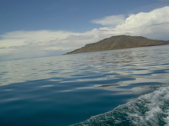
¡The World´s Highest Navegable Lake! -> Lake Titicaca
Early last wednesday morning I set sail with my new Swiss friend from the port of Puno (¡Peru´s ugliest city!) for the floating islands of the Uros. Built of reeds and mud, and tied together, these 45 or so islands float around Puno Bay attracting tourists. They were build during the Inca empire by the Uros, who wanted the empire to leave them alone. Today they are more or less floating souvenire stalls, as tourism is the only viable way of earning the cashmoney the people need to buy rice and potatoes from the mainland. Beacuse the reeds rot, everythign on the islands is rebuilt every 2 or 3 years, so it all looked really new, adding a bit to the disneyesque atmosphere. After a an hour or so around there we set off for the open lake and Isla Amantaní where we stayed with a local family and hiked up to the temple to the Pachamama (mother nature - ¡the most venerated deity in the andes!) to watch the sun go down. Island life seemed quite difficult; the fields where they said they grew potatos and quinua looked like quarries more than fields, and waiting for the rain was a perfectly acceptable way for the head of the family Nicolas to spend the day. There were almost no young people opn the island as as soon as they finish highschool (at 16-18 years old) most people hightail it to Lima or Arequipa to look for work, returning when they´re ready to settle down and start farming on the island. The same was true on Taquilla island which we visited the next day. The only source of income there being selling woven goods (the people there are recognized as ¡the world´s best weavers! by unicef) which are sold in a community run coop in the main plaza. The highlight of the trip was watching a party on Amantaní given in honor of the new mayor, where ¡the most drunk band in world! played musica del pueblo to about 200 people who held hands and ran around in a huge circle on the town´s basketabll court. wierd.
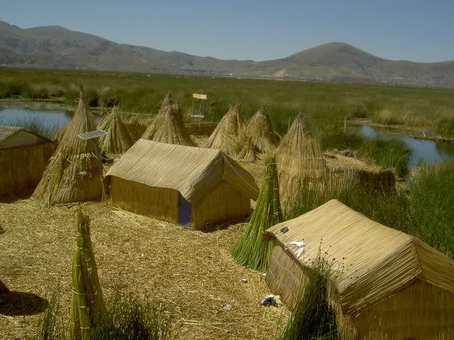
floating island, note the solar energy panel
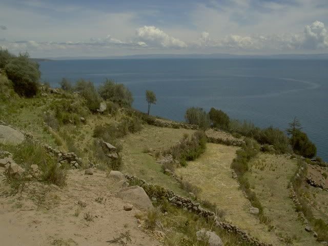
farms on amantaní
isla taquilla
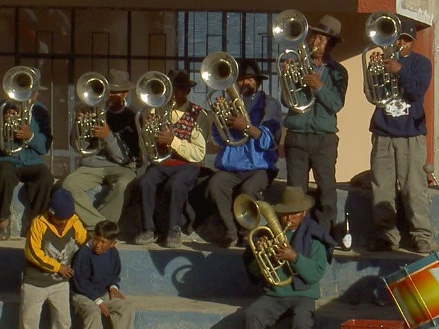
banda del peublo
¡The World´s Highest Capitol City! -> La Paz, Bolivia
Like Sydney and Toronto, La Paz isnt technically the capitol city although everyone thinks it is. Unlike the other 2 though, most of Bolivia´s government has upped and moved to La Paz making it ¡the most de-facto capitol in the world! It´s a crazy busy place overflowing with markets and barley fitting into the valley it sits in. It doesnt actually fit anymore, and on the ridge above La Paz is El Alto, one of Latin America´s famous Barrios Jovenes full of recent (and almost all indigenous) immigrants to the city from the countryside. There are some pretty plaza spread around the city and since there is much less hassle directed toward tourists than in Peru, its easy to sit and enjoy them. On the way into the city from Lake Titicaca the bus passed over miles and miles of the high Altiplano, where all the wall were covered with propaganda for Evo Morales and his Movimiento Al Socialismo party. He enjoys huge popularity in this part of the country, and while Santa Cruz in the south was having a protest against his government looking for political and economic autonomy, La Paz held a counterprotest supporting Morales and his plan to rewrite the constitution.
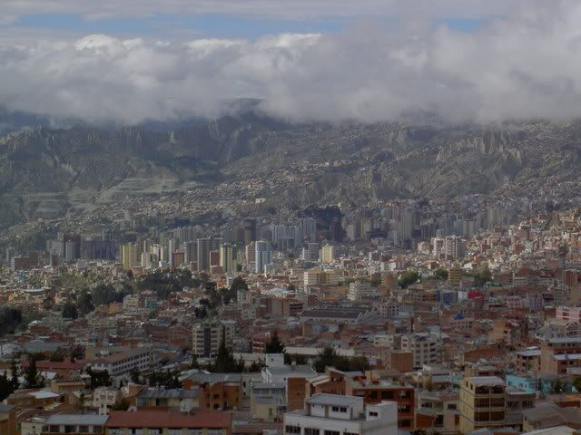
La Paz
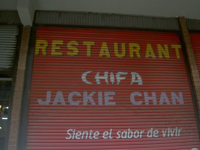
¡the best named chinese resturant ever!
¡The World´s Most Dangerous Road! -> La Paz to Coroico
The road from La Paz to Coroico (and onto the Yungas valleys ¡the most coca producing part of the world!) is about 1 car wide, gravel and mud, and perched on an erroding ledge with sheer drops off to one side). It descends over 4000meters from a peak above La Paz (complete with snow) down into the steamy semi-jungle valleys around Coroico. Until a new road was built to replace it, it was the only way between the two cities, and buses, trucks, and cars would ride up and down it, passing on blind corners, getting stuck in traffic jams, and falling of the edge at a terrifying rate; hence the title as the world´s most dangerous road. Today there isnt much traffic as the new road is paved and wide and has guardrails, so its pretty much safe for downhill bike riding. From La Cumbre the group of us descended down a paved road, out of the snowy peaks, through a high alpinestyle valley, and over a ridge to the start of the ¡¡death road!! itself. Tour agencies definatley play up the death danger doom angle, but even so, the ride down the gravel road was a crazy rush. Down and down and down (around 70km in total) with a cliff on one side and a cliff on the other. Knowing my tendancy to fall of bikes, maybe i´m quite lucky to be posting this, but it never felt that scary. Once we got to Coroico we rode up to hotel esmerlda to take ¡the world´s most refreshing shower! After a lunch, we got in a van and drove back up the new road to La Paz, it took about as long to get up in the car as it had to get down by bike.
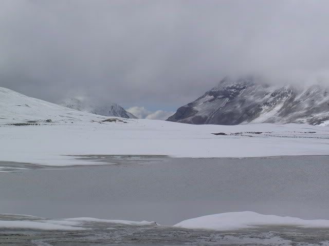
the start, la cumbre
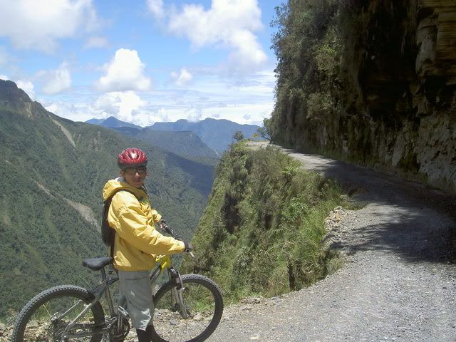
our guide and the road
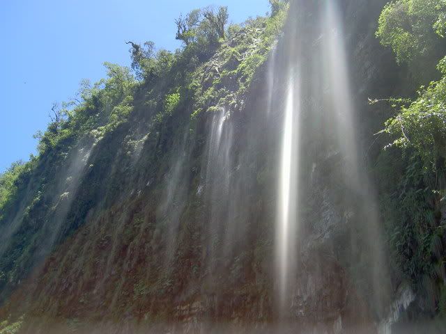
waterfall
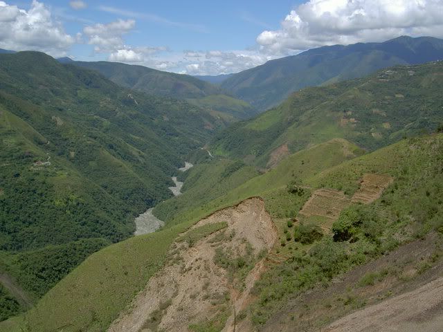
from the road of death toward las yungas
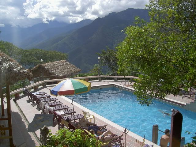
hotel esmeralda, bling bling!
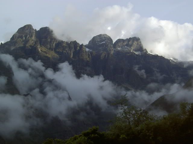
cloudy mountains on the way back up
Early last wednesday morning I set sail with my new Swiss friend from the port of Puno (¡Peru´s ugliest city!) for the floating islands of the Uros. Built of reeds and mud, and tied together, these 45 or so islands float around Puno Bay attracting tourists. They were build during the Inca empire by the Uros, who wanted the empire to leave them alone. Today they are more or less floating souvenire stalls, as tourism is the only viable way of earning the cashmoney the people need to buy rice and potatoes from the mainland. Beacuse the reeds rot, everythign on the islands is rebuilt every 2 or 3 years, so it all looked really new, adding a bit to the disneyesque atmosphere. After a an hour or so around there we set off for the open lake and Isla Amantaní where we stayed with a local family and hiked up to the temple to the Pachamama (mother nature - ¡the most venerated deity in the andes!) to watch the sun go down. Island life seemed quite difficult; the fields where they said they grew potatos and quinua looked like quarries more than fields, and waiting for the rain was a perfectly acceptable way for the head of the family Nicolas to spend the day. There were almost no young people opn the island as as soon as they finish highschool (at 16-18 years old) most people hightail it to Lima or Arequipa to look for work, returning when they´re ready to settle down and start farming on the island. The same was true on Taquilla island which we visited the next day. The only source of income there being selling woven goods (the people there are recognized as ¡the world´s best weavers! by unicef) which are sold in a community run coop in the main plaza. The highlight of the trip was watching a party on Amantaní given in honor of the new mayor, where ¡the most drunk band in world! played musica del pueblo to about 200 people who held hands and ran around in a huge circle on the town´s basketabll court. wierd.
floating island, note the solar energy panel
farms on amantaní
isla taquilla
banda del peublo
¡The World´s Highest Capitol City! -> La Paz, Bolivia
Like Sydney and Toronto, La Paz isnt technically the capitol city although everyone thinks it is. Unlike the other 2 though, most of Bolivia´s government has upped and moved to La Paz making it ¡the most de-facto capitol in the world! It´s a crazy busy place overflowing with markets and barley fitting into the valley it sits in. It doesnt actually fit anymore, and on the ridge above La Paz is El Alto, one of Latin America´s famous Barrios Jovenes full of recent (and almost all indigenous) immigrants to the city from the countryside. There are some pretty plaza spread around the city and since there is much less hassle directed toward tourists than in Peru, its easy to sit and enjoy them. On the way into the city from Lake Titicaca the bus passed over miles and miles of the high Altiplano, where all the wall were covered with propaganda for Evo Morales and his Movimiento Al Socialismo party. He enjoys huge popularity in this part of the country, and while Santa Cruz in the south was having a protest against his government looking for political and economic autonomy, La Paz held a counterprotest supporting Morales and his plan to rewrite the constitution.
La Paz
¡the best named chinese resturant ever!
¡The World´s Most Dangerous Road! -> La Paz to Coroico
The road from La Paz to Coroico (and onto the Yungas valleys ¡the most coca producing part of the world!) is about 1 car wide, gravel and mud, and perched on an erroding ledge with sheer drops off to one side). It descends over 4000meters from a peak above La Paz (complete with snow) down into the steamy semi-jungle valleys around Coroico. Until a new road was built to replace it, it was the only way between the two cities, and buses, trucks, and cars would ride up and down it, passing on blind corners, getting stuck in traffic jams, and falling of the edge at a terrifying rate; hence the title as the world´s most dangerous road. Today there isnt much traffic as the new road is paved and wide and has guardrails, so its pretty much safe for downhill bike riding. From La Cumbre the group of us descended down a paved road, out of the snowy peaks, through a high alpinestyle valley, and over a ridge to the start of the ¡¡death road!! itself. Tour agencies definatley play up the death danger doom angle, but even so, the ride down the gravel road was a crazy rush. Down and down and down (around 70km in total) with a cliff on one side and a cliff on the other. Knowing my tendancy to fall of bikes, maybe i´m quite lucky to be posting this, but it never felt that scary. Once we got to Coroico we rode up to hotel esmerlda to take ¡the world´s most refreshing shower! After a lunch, we got in a van and drove back up the new road to La Paz, it took about as long to get up in the car as it had to get down by bike.
the start, la cumbre
our guide and the road
waterfall
from the road of death toward las yungas
hotel esmeralda, bling bling!
cloudy mountains on the way back up
Labels: floating islands, la paz, lake titicaca, puno, road of death, yungas
# posted by jacob @ 4:18 PM 
![]()