Monday, October 30, 2006
¿why is it impossible to get a decent cup of coffee in a region that produces some of the world's best?
Like the vast majority of countries in the global south, Ecuador's is an export oriented economy. Since the Spanish conquest, it's resources have beeen extracted, at great expense to local populations and environments, and sent abroad. First it was gold, mined and lifted from the rivers, sent to spain, ultimately funding the industrialization of Europe and the emergence of capitalism. Because of it's great natural diversity Ecuador has produced, at one point or other, almost all of history's great cash crops: rubber, coffee, cocoa, coca, oil, bananas, flowers...
Things today aren't vastly different than they were during the mercanitle, ecomienda, or hacienda eras. Because of power inequalities reinforced by the terms of international trade, countries in the global south are forced to export raw materials (at the lowest possible price) and import finished goods (at great expense). IMF/World Bank loans and the consequent structural adjustment policies (SAPs) stipulate that countries must eliminate protective tariffs and agricultural subsidies so that a worldwide level plaving field is created. The trouble is that rich coutnries aren't dependent on loans from the global financial institutions and so aren't subject to SAPs; their protective tariffs and subsidies are left intact. So, while small farmers in the south are 'competing' for global markets with corporate agroindustry, rich states, and each other, their local markets are flooded with imported goods at prices they can't match. And so, as farming becomes a decreasingly viable option, people leave the country for the city, for other countires - the rural exodus intensifying processes of urbanization and emmigration. Wide open and unused rural spaces here indicate a region's poverty and the disutlity of organizing the world on concepts of relative advantage and global markets.
Two example from further afield are plainly illustrative. For the last few years, under pressure from the usual internatinal institutions, the government of Mali has been reducing, with the ulimate aim of eliminating, subsidies for cotton farmers. Although cotton is a relatively low capital intense crop, farmers still have to buy seed, fertilizer, transport, and for planting and harvesting equipment; for most Malian farmers this requires taking out loans. For US cotton producers on the hand, these costs are paid for by government subsidies, meaning they can sell their cotton at any price and make a profit. To compete with these prices in the global market, Malian farmers have to sell at barely above (or even blow) their cost of production, their labor left valueless, because of the loans they enter a cycle of endebtedness. This precarious existence is marginal at best and season to season survival is questionable; a dry year, locusts, or any number of factors leaving farmers with all the debt and none of the product of a 'good' year.
On the other side of Mali's southern border lies the Ivory Coast, the world's leading cocoa produce and exporter; despite that, you'd be hard pressed to find an Ivorian bar of chocolate. Because cocoa doesnt grow in Switzerland, Belgium, France etc, the chocolatiers in these countries (mom and pop outfits like Nestle and Lindt) need to import all their cocoa. To facilitate this, these countries' governments keep taxes low on the import of raw or semi-processed materials. Conversely, tariffs on finished goods (like bars of chocolate) are kept high to protect 'local' industry. The result is that even if the Ivory Coast produced chocolate (which would require capital for factories, and, if it were to compete globally, a world wide advertising campaign) there'd be nowhere to sell it. And at the same time, because SAPs keep the country's tariffs on imports low, the European giants are able to sell as much of their product (not just chocolate, but powdered milk - with its own set of problems) on local markets as possible.
So finally, to coffee. While Columbia Ecuador, Peru, and Bolivia (not to mention their Central American counterparts) produce some of the best coffee in the world (take a look at the fancy coffee section in a fancy grocery store) the morning cup here in Latin America is always Nescafe: imported from Columbia with all the revenue going to Switzerland. The same structures that affecting the cotton and cocoa trades shape the coffee trade, so all the good stuff is sent abroad and mass produced substitutes are imported. The same is true for virtually every commodity traded on 'the global level playing field' of neoliberal freetrade. This, I think, is part of the answer to the question I come face to face with every morning over my (nes)cafe-con-leche.
The Fair Trade movement ostensibly adresses some of these problems, but, it leaves the basic structure of inequality intact in doing so. So whole empowering rural communities, protecting human rights and the environment, and advocating a living wage are obviously laudable goals, it is less clear if that gourmet coffee and chocolate (as tasty as they may be) are viable means of achieving them. Fair trade placed the burden of change of individual consumers (clearing corporations of responsability) the vast majority of whom simply cannot pay gourmet prices. Ultimately fair trade functions more effectively in easing the consiences of left leaning bourgeois than in changin the nature of global trade. Even with fair trade, the global south is territorializes as a net exporter of consumer goods and placed at an overall disadvantage in power relations with the north.
and if all that's not messed up enough, they guy next to me in the cyber cafe has been singing linkin park loud for 30 minutes. urgh. globalization: pretty much sucks right now.
Friday, October 27, 2006
in the jungle, the mighty jungle
lions, as a matter of fact, don´t live in the jungle, they live exclusively in the plains...
I met Gustavo (my spanish teacher and travel partner for the week) early on sunday morning at Quito´s main bus station. We were the first on the bus heading south and east to Tena, on of the main cities of Ecudor´s eastern region, and the gateway to the Amazon. as it left the station there were only a few other riders on the bus, but within 100 yards of leaving the station gates, the bus was packed, standing room only, without actually coming to a stop. Because there is a .50$ tax on tickets purchased at the station proper, people congregate just outside to hop onto the slowly rolling busses. 5 hours, and 2 Schwazenegger masterpeices later we arrived in Tena. The ride had been pretty spectacular, riding east through the Sierra and eventually down through the cloud forest, where the drizzle actually made things more dramatic, and eventually into the amazon basin. We left Tena itself pretty quickly, onto the Shangrila cabins, built like a peterpan/swiss family robinson tree house on the top of a cliff looking back west over the rio anzu and a strectch of secondary (aka once a rubber plantation) forest to the mountains.
In the mornings we had steamy sessions with that most impenetrable, confounding, and doubt ridden of subjects, el subjuntivo...our first afternoon we went to explore the canyons with Jose, who told us about the medicinal plants we passed along the way (one is to repel snakes). The canyons were two very narropw gorges formed over time by two tiny trickles of water, that I assume are a bit bigger after some rain. We climbed down into the first, walked down it until it met the second, then walked upstream as that canyon narrowed and narrowed until we eventually had to shimey up and out of it. The next day we caught a ride up river and tubed back down, stopping on the way to visit a small (80 person, 2 family, 2 soccer field) community on the river. After three nights at Shangrila we headed off to our second base, the Amarongatchi Cabins. We caught an early ride back through Tena in Mauricio´s pickup; to get to these second cabins we drove to the end of the paved road out of Tena (about 10 miles) and then along the unpaved section for another 6 or so...we rode over a rickety ´temporary´ bridge that had been there since a huge storm in march washed out the real one; ´they told us they´d replace it by august´ said Mauricio, ´but i suppose its not technically lying since they didn´t say august of which year´.
Later that morning we hiked through the primary (meaning only native plants) forest to a small river which we followed upstream for 2 hours until we reached a series of 3 huge waterfalls. Jose scrambled up first, tied a rope around boulders, then dropped it down to us so we could walk up the falls. The second of the three had a perfect little swimin´hole at the bottom so we stopped for 20 minutes to cool off. The next afternoon we hiked to the end of the road, where a less dramatic (less long/steep) waterfall dropped into the Rio Grande. About two thirds of the way down the falls was a pool, about 10 yards square and 10 feet deep, the best swimin´hole ever (sorry rappahanock)...Gustavo, Jose, Eduardo, and I spent about an hour hangin out on the rocks on the edge, jumping into the pool, and using the falls as a waterslide. When we finshed we hoped into the tubes we´d brought with us and floated down the river back to the cabins. That night it rained. From about 6 to 10, and again, for good measure, from 2-4 as hard as possible. The four of sheltered in the dinning room playing round after round of cuarenta (Ecuador´s most popular cardgame) by candlelight. The next morning Gustavo and I were due to leave, and we waited at the edge of the road for our ride. and waited, and waited. eventually a boy rode by on a bike and told us the news: last night´s storm washed out the bridge, no trucks were getting past. So we walked, and walked, and walked. A few hours later we arrived at the paved road and bus (luckily one had been caught on our side of the bridge) was idling. We sprinted to it (idling is a rare state for Ecuadorian buses, they dont sit still for long) and hoped on for a ride the last few miles to bridge. We clambered over the remains to the otherside where Mauricio was waiting for us. Back in tena we drank a tall glass of pinapple juice and caught the nxt bus to Quito, 5 hours and a Big Moma´s House marathon (¿they made a sequel?) later we arrived, exhausted.
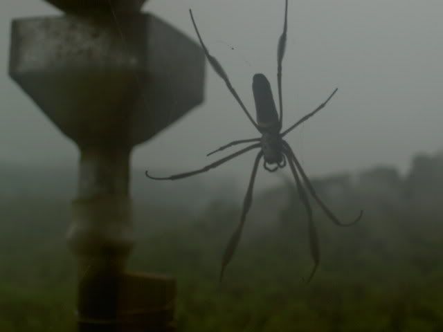
the welcoming party at shangrila
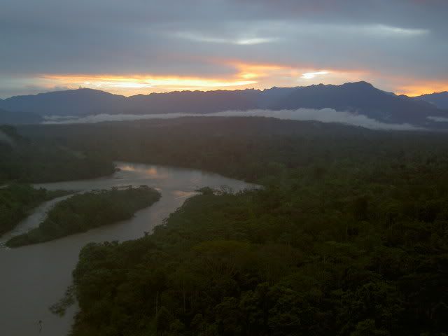
view from the cabin, not too shabby
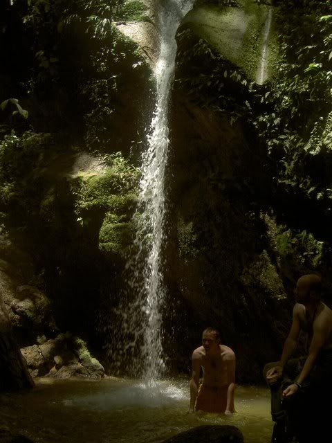
swimin hole!
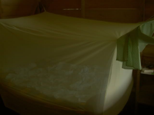
the fourposter bed of the tropics
this bird couldnt even talk
gustavo playing cards
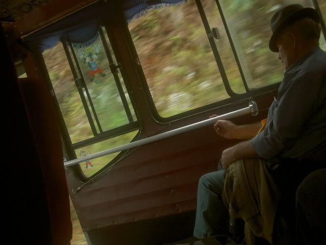
on the bus ride home
I met Gustavo (my spanish teacher and travel partner for the week) early on sunday morning at Quito´s main bus station. We were the first on the bus heading south and east to Tena, on of the main cities of Ecudor´s eastern region, and the gateway to the Amazon. as it left the station there were only a few other riders on the bus, but within 100 yards of leaving the station gates, the bus was packed, standing room only, without actually coming to a stop. Because there is a .50$ tax on tickets purchased at the station proper, people congregate just outside to hop onto the slowly rolling busses. 5 hours, and 2 Schwazenegger masterpeices later we arrived in Tena. The ride had been pretty spectacular, riding east through the Sierra and eventually down through the cloud forest, where the drizzle actually made things more dramatic, and eventually into the amazon basin. We left Tena itself pretty quickly, onto the Shangrila cabins, built like a peterpan/swiss family robinson tree house on the top of a cliff looking back west over the rio anzu and a strectch of secondary (aka once a rubber plantation) forest to the mountains.
In the mornings we had steamy sessions with that most impenetrable, confounding, and doubt ridden of subjects, el subjuntivo...our first afternoon we went to explore the canyons with Jose, who told us about the medicinal plants we passed along the way (one is to repel snakes). The canyons were two very narropw gorges formed over time by two tiny trickles of water, that I assume are a bit bigger after some rain. We climbed down into the first, walked down it until it met the second, then walked upstream as that canyon narrowed and narrowed until we eventually had to shimey up and out of it. The next day we caught a ride up river and tubed back down, stopping on the way to visit a small (80 person, 2 family, 2 soccer field) community on the river. After three nights at Shangrila we headed off to our second base, the Amarongatchi Cabins. We caught an early ride back through Tena in Mauricio´s pickup; to get to these second cabins we drove to the end of the paved road out of Tena (about 10 miles) and then along the unpaved section for another 6 or so...we rode over a rickety ´temporary´ bridge that had been there since a huge storm in march washed out the real one; ´they told us they´d replace it by august´ said Mauricio, ´but i suppose its not technically lying since they didn´t say august of which year´.
Later that morning we hiked through the primary (meaning only native plants) forest to a small river which we followed upstream for 2 hours until we reached a series of 3 huge waterfalls. Jose scrambled up first, tied a rope around boulders, then dropped it down to us so we could walk up the falls. The second of the three had a perfect little swimin´hole at the bottom so we stopped for 20 minutes to cool off. The next afternoon we hiked to the end of the road, where a less dramatic (less long/steep) waterfall dropped into the Rio Grande. About two thirds of the way down the falls was a pool, about 10 yards square and 10 feet deep, the best swimin´hole ever (sorry rappahanock)...Gustavo, Jose, Eduardo, and I spent about an hour hangin out on the rocks on the edge, jumping into the pool, and using the falls as a waterslide. When we finshed we hoped into the tubes we´d brought with us and floated down the river back to the cabins. That night it rained. From about 6 to 10, and again, for good measure, from 2-4 as hard as possible. The four of sheltered in the dinning room playing round after round of cuarenta (Ecuador´s most popular cardgame) by candlelight. The next morning Gustavo and I were due to leave, and we waited at the edge of the road for our ride. and waited, and waited. eventually a boy rode by on a bike and told us the news: last night´s storm washed out the bridge, no trucks were getting past. So we walked, and walked, and walked. A few hours later we arrived at the paved road and bus (luckily one had been caught on our side of the bridge) was idling. We sprinted to it (idling is a rare state for Ecuadorian buses, they dont sit still for long) and hoped on for a ride the last few miles to bridge. We clambered over the remains to the otherside where Mauricio was waiting for us. Back in tena we drank a tall glass of pinapple juice and caught the nxt bus to Quito, 5 hours and a Big Moma´s House marathon (¿they made a sequel?) later we arrived, exhausted.
the welcoming party at shangrila
view from the cabin, not too shabby
swimin hole!
the fourposter bed of the tropics
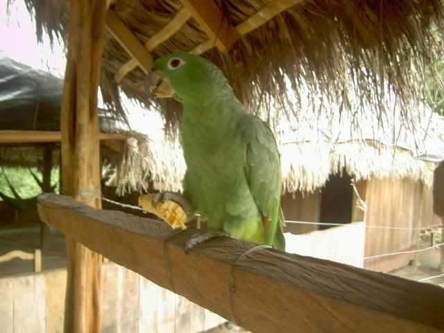
this bird couldnt even talk
gustavo playing cards
on the bus ride home
Saturday, October 21, 2006
in which i conquer my fear of volcanoes
when i was about 7 or 8, i went to see a documentary at the air and space museum´s fancy 3-d surround sight&soound movie theater. the name of the movie was RING OF FIRE or something very similar. it was about all the volcanoes on the pacific rim and the pacific islands and had tons and tons of footage of volcanoes blowing up and lava flowing out and shit getting fucked up. i.was.terrified. for the next few nights i worried about what would happen when (not if, when) a volcano would blow up and fuck everything i knew up. i created plans of what stuff i would grab as i fled my house (my giant world map, and my rabbit) to who knows where. it didnt really bother me that the closest volcano to reston virginia is in washington state...all i knew was that lava was fucking scary and would probably get at me no matter what...since then i´ve come in contact with a few volcanos with minimal flashbacks, but ecuador is the land of the volcano. i live in the shadow of one (pichincha) and everywhere i go there´re new ones, waiting. so in the last few weeks i´ve done a lot to finally put to bed my first phobia. (photos at the end)
stage 1 - Cubilche
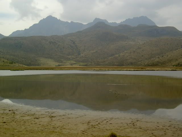
this was a pretty easy first step, given that Cubilche is long extinct and poses no threat to anyone...excepts idiots like me and the few others from spanish school that decide to walk up it. we left quito on friday afternoon, heading north to the small village of la esperanza at the base of Cubilche and the active Imbabura...saturday morning bright and early we met up with our guide (during the week a constrcution worker in nearby Ibarra, afterwork a marathon runner, and mountain treker) who lead us up the country road to where the assent really started. it took about 3 breathless hours to get to the top, where there was a pretty little lake...on the way down and around, we got a pretty sweet view of Cayambe, another volcano, this one snow capped...long day, but a good start
stage 2 - pichincha
this is quito´s volcano. there is a gondola that runs up to about 4100m above sea level (you figure it out) and from there you can walk up and up to the sumit. Pichincha is still active, in 1999 it spewed loads of smoke and crap ove quito, its a few years overdue for a major eruption too, so watch it. after the ride up, i had a wander round, admired the views over all of quito, wondered what the hell a horse was doing up there, and rode back down...in the gondola with me was a friendly guy called jorge, we chatted about all sorts of things (mountians predictably, music he was a huge pink floyd and ¿thunderwing? fan, and then he asked me if i believed in aliens...at first i thought he was talking about god because he kept pointing at the sky, so i was honest and said no...as soon as he started talking about green things and flying plates i realized my mistake and quickly changed my answer to ´who knows, there´s a lot of space out there´)
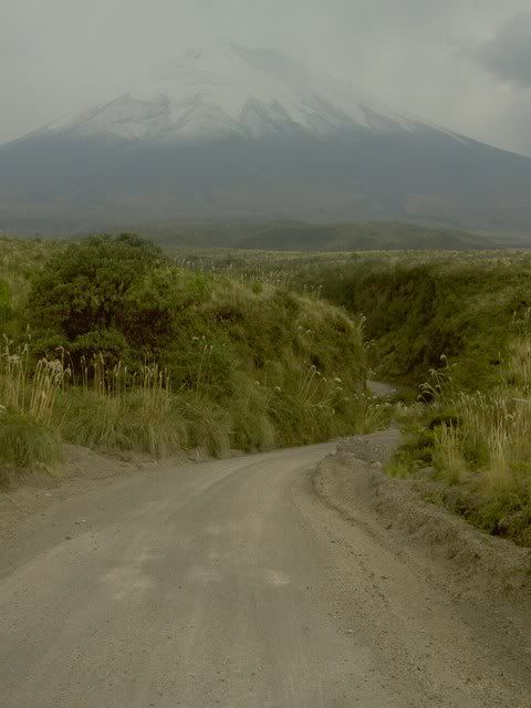
stage 3 - cotopaxi
cotopaxi is ecuador´s most picturesque volcano, its about an hour´s drive south of quito. its active, and due to blow up big time in the next 15 years or so...it has already destroyed the city of Latacunga three times, and will do it again (or so says the guide). for this one i took a trip`with a mountain biking outfit that sends people up mountains in jeeps, and then lets them fly down on bikes...(i was sold withing 2 seconds). we arrived at the gravelly parking lot on the volcano´s south slope at about 8am, then camilo (a guy from quito doing the same trip) and i walked uphill for about 45 minutes to the climber´s refuge. climbers usually spend the night here to get aclimatized to the altitude before waking up early to takle to glaciers on the way up to the summit...once we got back down to the jeep we picked our bikes off the roof and started down. the road is unpaved and a bit rough, at times it felt like riding over a kiddy sand pit (full of kids) or a giant ashtray after a truck full of bricks had crashed...after about an hour of racing down hill we got to a little lake, where we had lunch, then we rode around the volcano for another 2 hours to the park exit and got back in the jeep...
so thats that...and here´s the evidence-
stage 1
looking down culbilce from about a third of the way up
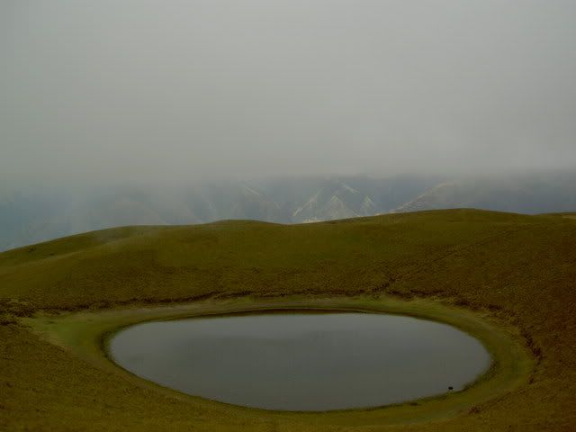
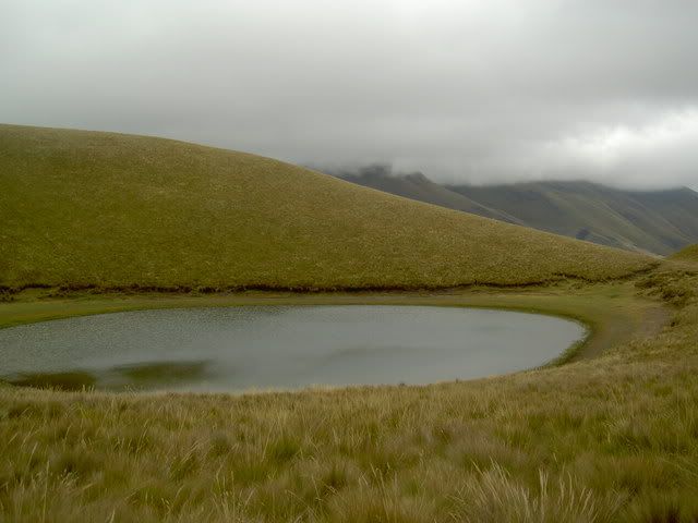
moutain lake...looked a bit cold for a swim
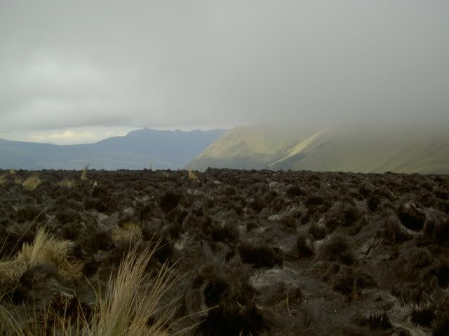
there had been a fire at the sumit, it looked like the moon
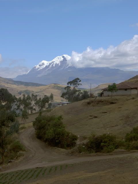
cayambe on the way down
stage 2
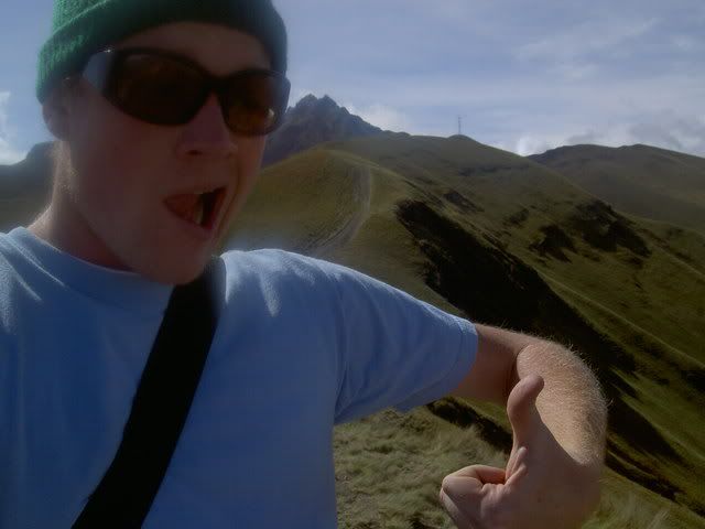
some douchebag blocking my view of pichincha
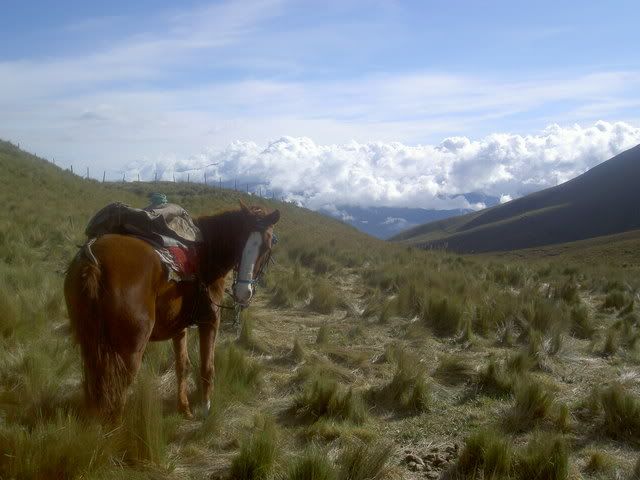
how the fuck did this horse get up here? the gondola?
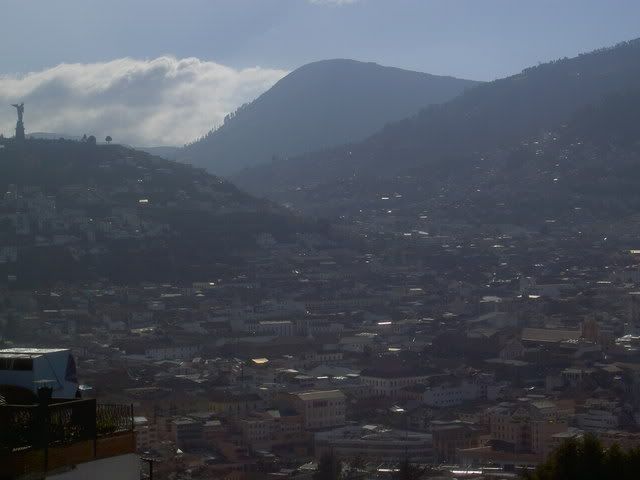
old town quito from pichincha...that statue is of a giant virgin
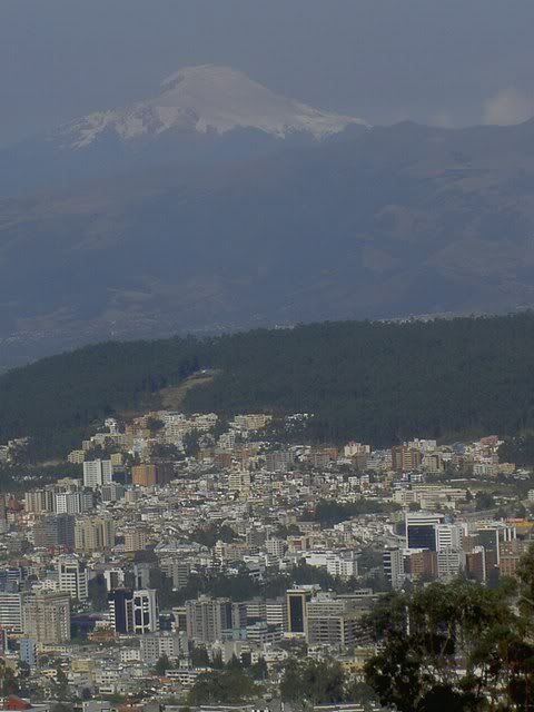
new town quito...mountain in the background is Cayambe
this is the area i live in
stage 3
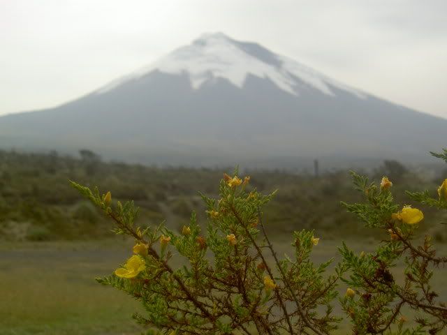
cotopaxi
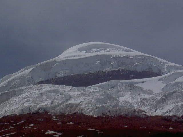
glaciers at the peak
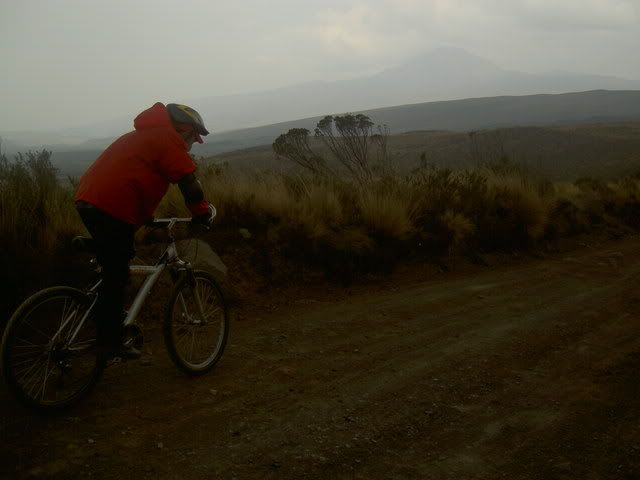
riding down
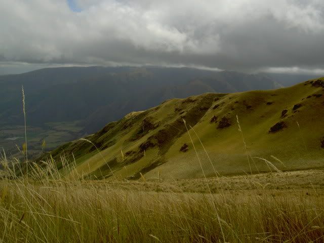
lake...i forgot the name of the mountains in the back, but they are inbetween the highway and cotopaxi...they look mighty like a bird with spread wings
the road out of the park
stage 1 - Cubilche
this was a pretty easy first step, given that Cubilche is long extinct and poses no threat to anyone...excepts idiots like me and the few others from spanish school that decide to walk up it. we left quito on friday afternoon, heading north to the small village of la esperanza at the base of Cubilche and the active Imbabura...saturday morning bright and early we met up with our guide (during the week a constrcution worker in nearby Ibarra, afterwork a marathon runner, and mountain treker) who lead us up the country road to where the assent really started. it took about 3 breathless hours to get to the top, where there was a pretty little lake...on the way down and around, we got a pretty sweet view of Cayambe, another volcano, this one snow capped...long day, but a good start
stage 2 - pichincha
this is quito´s volcano. there is a gondola that runs up to about 4100m above sea level (you figure it out) and from there you can walk up and up to the sumit. Pichincha is still active, in 1999 it spewed loads of smoke and crap ove quito, its a few years overdue for a major eruption too, so watch it. after the ride up, i had a wander round, admired the views over all of quito, wondered what the hell a horse was doing up there, and rode back down...in the gondola with me was a friendly guy called jorge, we chatted about all sorts of things (mountians predictably, music he was a huge pink floyd and ¿thunderwing? fan, and then he asked me if i believed in aliens...at first i thought he was talking about god because he kept pointing at the sky, so i was honest and said no...as soon as he started talking about green things and flying plates i realized my mistake and quickly changed my answer to ´who knows, there´s a lot of space out there´)
stage 3 - cotopaxi
cotopaxi is ecuador´s most picturesque volcano, its about an hour´s drive south of quito. its active, and due to blow up big time in the next 15 years or so...it has already destroyed the city of Latacunga three times, and will do it again (or so says the guide). for this one i took a trip`with a mountain biking outfit that sends people up mountains in jeeps, and then lets them fly down on bikes...(i was sold withing 2 seconds). we arrived at the gravelly parking lot on the volcano´s south slope at about 8am, then camilo (a guy from quito doing the same trip) and i walked uphill for about 45 minutes to the climber´s refuge. climbers usually spend the night here to get aclimatized to the altitude before waking up early to takle to glaciers on the way up to the summit...once we got back down to the jeep we picked our bikes off the roof and started down. the road is unpaved and a bit rough, at times it felt like riding over a kiddy sand pit (full of kids) or a giant ashtray after a truck full of bricks had crashed...after about an hour of racing down hill we got to a little lake, where we had lunch, then we rode around the volcano for another 2 hours to the park exit and got back in the jeep...
so thats that...and here´s the evidence-
stage 1
looking down culbilce from about a third of the way up
moutain lake...looked a bit cold for a swim
there had been a fire at the sumit, it looked like the moon
cayambe on the way down
stage 2
some douchebag blocking my view of pichincha
how the fuck did this horse get up here? the gondola?
old town quito from pichincha...that statue is of a giant virgin
new town quito...mountain in the background is Cayambe
this is the area i live in
stage 3
cotopaxi
glaciers at the peak
riding down
lake...i forgot the name of the mountains in the back, but they are inbetween the highway and cotopaxi...they look mighty like a bird with spread wings
the road out of the park
Friday, October 06, 2006
todo va bien
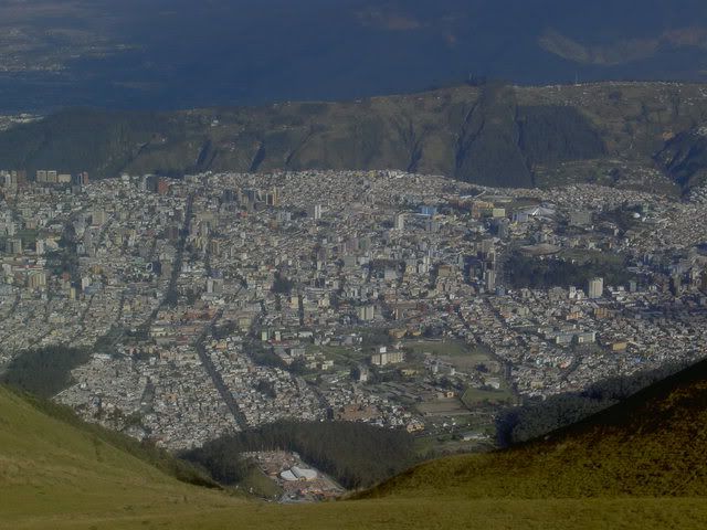
well, quito.
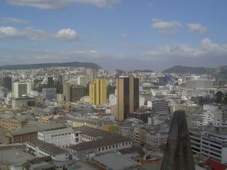
surrounded by the andes it sprawls north to south for ever and ever. but some neighborhoods are prettier than others...claro.
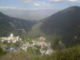
Guapulo is among the nicest. on the backside of one of the mountains, this is the "bohemian" neighborhood. because it´s so steep, no houses are actually next to each other, and people have gone to extreme lengths to build houses that reject the hill. but the inequality in the city is as evident here as in most other neighborhoods
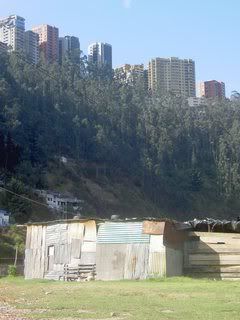
the skyscrapers in the background are apartments in one of Quito´s swankiest neighborhoods...houses like the one in the foreground are squeezed inbetween. the neighborhood i live in is not the prettiest, but there is a lot of life in streets...garages are turned into convenience stores, cafes, tailors, and shops turning what was originally planned as a residencial area into a mixed use one with storefronts on the streets and apartements in the buildings behind. The neighborhood is in the center of the valley, and if you walk up the hills in either direction you find universities...la universidad central (the only public university in quito) on one side, and the universidad catolica on the other. the result is a fairly lively neighborhood inbetween.
way in the north of the city is the stadium where Liga de Quito play their home games.
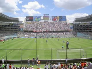
Last sunday they played out a 3-3 tie with their rivals Barcelona de Guayquil...the stadium was full and everyone was singing and jumping for the whole game...guyaquil fans in the tier above ours took things pretty seriously, throwing dirty water and peices of shit down onthe the quito fans below when Liga scored the equalizer...
im hesitant to say it but maybe somethings have universal significance...
quito, ecuador--->
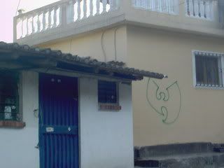
timbuktu, mali--->
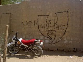
besides wu-tang, the graffiti is mainly political, and mostly anarchist, with lots of references ot the upcoming elections and the TLC (free trade ageement)..."don´t vote, disobey" is a popular tag as is "la policia nacional, la policia criminal".
surrounded by the andes it sprawls north to south for ever and ever. but some neighborhoods are prettier than others...claro.
Guapulo is among the nicest. on the backside of one of the mountains, this is the "bohemian" neighborhood. because it´s so steep, no houses are actually next to each other, and people have gone to extreme lengths to build houses that reject the hill. but the inequality in the city is as evident here as in most other neighborhoods
the skyscrapers in the background are apartments in one of Quito´s swankiest neighborhoods...houses like the one in the foreground are squeezed inbetween. the neighborhood i live in is not the prettiest, but there is a lot of life in streets...garages are turned into convenience stores, cafes, tailors, and shops turning what was originally planned as a residencial area into a mixed use one with storefronts on the streets and apartements in the buildings behind. The neighborhood is in the center of the valley, and if you walk up the hills in either direction you find universities...la universidad central (the only public university in quito) on one side, and the universidad catolica on the other. the result is a fairly lively neighborhood inbetween.
way in the north of the city is the stadium where Liga de Quito play their home games.
Last sunday they played out a 3-3 tie with their rivals Barcelona de Guayquil...the stadium was full and everyone was singing and jumping for the whole game...guyaquil fans in the tier above ours took things pretty seriously, throwing dirty water and peices of shit down onthe the quito fans below when Liga scored the equalizer...
im hesitant to say it but maybe somethings have universal significance...
quito, ecuador--->
timbuktu, mali--->
besides wu-tang, the graffiti is mainly political, and mostly anarchist, with lots of references ot the upcoming elections and the TLC (free trade ageement)..."don´t vote, disobey" is a popular tag as is "la policia nacional, la policia criminal".
![]()